|
||

|
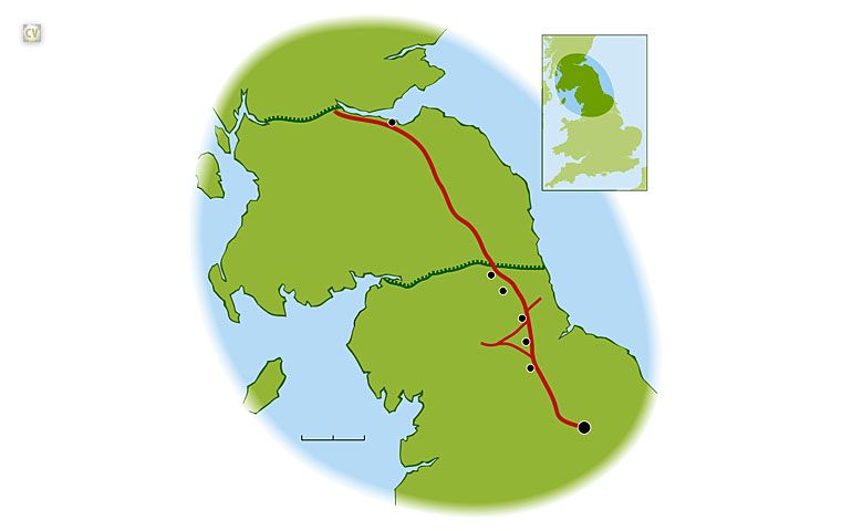
4. This map shows Hadrian's Wall (built AD 120) and the shorter Antonine Wall (built AD 140) to the north and how they were supplied by the Roman road called Dere Street. Major forts are shown as black discs. The large black disc is York. |

|

|
|
||
|
|
4. This map shows Hadrian's Wall (built AD 120) and the shorter Antonine Wall (built AD 140) to the north and how they were supplied by the Roman road called Dere Street. Major forts are shown as black discs. The large black disc is York. |
|