|
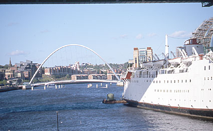
The famous Tyne Millenium Bridge (2000), the latest addition to Newcastle/Gateshead's collection of famous bridges.The Tyne has two headwater branches, the North and South Tyne, which drain the borderlands between Scotland and Northumberland in England. The Tyne flows east to reach the North Sea to the east of the port of Newcastle. The Tyne is one of the largest rivers in northeastern England. Its headwaters are the South Tyne, which begins south of Alston in Milburn Forest, and the North Tyne, which begins in Kielder Forest Park on the southern slopes of the Cheviot Hills.
The South Tyne begins its journey flowing north from where it begins close to the headwaters of the Tees. Here it is close to the western side of the main Pennine hills.
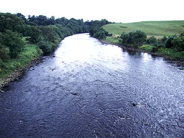 The upper reaches of the River West Allen which flows into the South Tyne at Bardon Mill.The Tyne flows below Alston and up toward Haltwhistle, before making a dramatic turn eastward. At this point it is close to Carlisle, but despite the longer distance to the sea, it is the Tyne that captures the headwater and takes it down to Haydon Bridge.
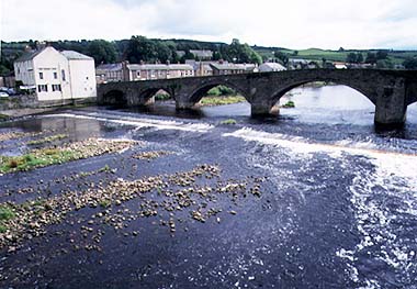
The South Tyne at Haydon Bridge. Now by-passed by a more modern structure, this is one of the traditional crossing points of the South Tyne.This is a river which has considerable flow in times of heavy rain on the Pennines. The river valley is also floored with boulder clay left after the ice sheets departed at the end of the Ice Age. As a result, the river has a very bouldery bed and its wide meandering channel almost changes to a braided channel in places. The North Tyne has its headwaters on the southern slopes of the Cheviot Hills. Now dammed to make one of Europe's largest reservoirs, the North Tyne quickly becomes Kielder Reservoir. The older course of the river through Bellingham to Hexham flows over a valley floor covered with boulder clay left, as the South Tyne, from the last Ice Age. The North Tyne is not as given to great changes in flow as its larger brother the South Tyne and its course is that of a large meandering river, with none of the bouldery bed seen in the South Tyne.
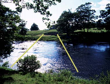
The Romans built two bridges over the North Tyne. The yellow lines show you the line of the former bridges. Remains are found on both banks where they make a heritage site.
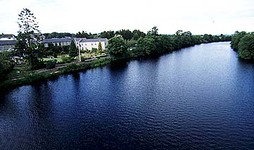
The North Tyne above HexhamJust above Hexham (the largest center on the Tyne except for Newcastle), the South and North Tyne meet. The Tyne, now a large river, flows in a fairly steep sided valley all the way to Newcastle and the sea. Even at Newcastle the Tyne has steep banks, hence all but one of the bridges are high level. Below Newcastle the river widens into an estuary. This estuary was formed in the last Ice Age in two stages. First, when the Ice Age started and sea levels fell, the river cut down to the new sea level. Then, at the end of the Ice Age when the ice melted and sea levels rose, the lower part of the valley was flooded, producing an estuary.
Places on the Tyne
NewcastleNewcastle lies on the north bank of the River Tyne about 13 km from the sea. Opposite lies Gateshead. Newcastle was founded as a fort close to the present castle. The Romans established a bridge across the Tyne (now the site of the Swing Bridge). The intention was to protect both the river crossing and invasions from the sea. The name Newcastle comes from the founding of a castle in the 11th century. Newcastle continued to be an important place to defend, as it was subject to attack from Scotland. As a result the new castle was replaced by yet another castle, the one that still stands, and a new bridge was built on the site of the Roman Bridge. Because of the threat of invasion, the city walls were also built. These defenses made it attractive for merchants and also religious orders to live at Newcastle, hence promoting the growth of the city. By the 16th century the trade of the city changed, as the export of coal by coastal boat to London became an important part of the trade. By the 18th century ironworking, shipbuilding and glassmaking were all to be found along the banks of the Tyne. There are six bridges and a tunnel linking Gateshead with Newcastle. The most famous is the Tyne Bridge built in 1928. Much older is the High Level Bridge, the main Edinburgh to London line. It was completed in 1849. The Swing Bridge was completed in 1876 and was an engineering marvel of its time.
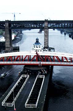
The Swing Bridge is on the site of the oldest bridge in Newcastle. The Swing Bridge was built to allow ships to reach the shipyards that used to be further up river. The High Level Railway Bridge can be seen behind it. The picture looks up river from the Tyne Bridge.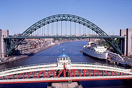
The famous Tyne Bridge (1928), a suspension road bridge and the symbol of Newcastle. |