|

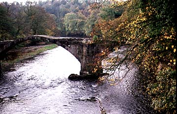
The Irwell in Moses Gate Country Park, Little Lever.
The Irwell Canal.
The Irwell.
The Irwell, a tributary of the Mersey is not navigable, and although it provides a source of water power for textile processing and soft water for dye making, the valley was used primarily as a route for canals and a source of water for them. The upper part of the Irwell is firmly entrenched in the Pennines. Where it comes out of the Pennines and reaches the North Lancashire Plain it is a much easier place to reach and to defend. This is why the Romans became interested in the site and founded Manchester (chester = Roman for fort) a Roman fort, Manenum, on the military road between Chester and York. The presence of the River Irwell was not particularly significant because it was a small river. It was simply a useful additional feature for the Romans mainly because of its defensible marshes. In Norman times, a castle was built for the defense of Manchester. In many ways, the Irwell was a handicap. Its narrow valley was difficult to follow in its upper course, and its lower course had floodplains that were marshy and which limited development for centuries. The limits to the usefulness of the Irwell were the reason why canals were so urgently needed in the area. The river itself could not conveniently be canalised.
By 1801 Manchester had grown to 84,000 people. At this time the Industrial Revolution was well underway and Manchester is described as a manufacturing, merchant and trading town filled with warehouses and factories. Although an ancient center, almost all of the old buildings had been removed by 1801 to make way for the factories, warehouses and new homes required for the textile industry. Only the ancient street pattern therefore remained. Spinning was the very foundation of the early 19th century city. Some factories employed up to 70,000 spindles capable of spinning in total some 500 million metres of fibre a week. Although until the middle of the 18th century all cotton yarn had been spun by hand, by 1801 the industry was becoming ever more productive, especially at the ending of Arkwright's patent on the loom, because people could then freely copy the design of the textile machines. At this time the Irwell ran to the west of the city, with the River Irk forming the northern boundary. The Rochdale and Bridgewater canals lay in open fields to the south of the city, as did the River Medlock with its wide marshy floodplain. Dean's Gate, Long Gate, Green Gate and St Mary's Gate were still dominant roads, much as they had been since Roman times when they were the approach roads to the fort gates. The Old Bridge over the Irwell was sited close to where the ancient roads met. However, by 1801 a new bridge was required, and this connected Manchester to Salford, a little south of the Old Bridge. At this time there was no railway. That would have to forge its way into the town as best it could. Cloth weaving had been introduced. in the 13th or 14th century. Manchester 'cottons' (woollens) were in high repute in the 17th century, and later history concerns itself chiefly with spinning and weaving machinery, the factory system, the utilisation of steam power, and facilities of transport, the first of which was the great enterprise of the Bridgewater Canal, 1772.
By 1855 Manchester had exploded in size and was then home to 316,000 people. At this time Manchester was described by a visitor arriving from the countryside: "A stranger approaching the city, by road or by railway, bids farewell to the amenities of open scenery, makes speedy acquaintance with the smoke and noise of factories, to see the very sky changing from a clear to a grayish blue, becomes surrounded with crowded indications of traffic and manufacture, and passes at last into what seems almost a chaos of mills and warehouses." At this time the city was again being restructured and many of its old streets widened. Market Street, once a narrow lane, was dramatically widened to its present shape. The Town Hall and other grand public buildings were also constructed at this time, based on classical buildings in Greece. Great new railway lines also converged on the city, pushing their way into Victoria, Oxford Road (now Piccadilly) and New Bailey Street stations. In doing this they marked out the edge of the city at this time. Victoria station, in particular, was built on a site between the Irk and the Irwell that was formerly meadowland. Piccadilly station was built just off the flood plain of the Medlock. Cotton production had increased nearly a thousand fold from 1801 to 1855 when there were 96 cotton mills, 10 silk mills, 6 calico printing works, 35 dye works, 1 worsted mill, 11 hat factories, 61 machine-making factories, 55 foundries, 4 leadworks, 4 paper mills and 1743 warehouses. All this change was brought about by the steam engine which worked the mills and powered the railroads. The rivers could not help much in this except provide flat land for building and water for processing. It was the canals that carried the coal to the mills and the railway that moved the products across country. But the city was feeling the need for its own port more and more. Its trade was dependent on Liverpool and the railway connection, and this made the people of Manchester uncomfortable. It would not be long before they did something about it. At this time the city leapt south far across the Medlock flood plain. New water reservoirs, using diverted river waters up river of the city, for the increasingly large number of city folk were also opened at Holt Town. Salford spread to occupy all of the northern loop of the Irwell and the Bolton canal was built. But other areas remained as yet beyond the reach of the city. Many were marshy, as hinted at in the name, for example of Moss Side. Its growth would await the development of the tram system later in the century and the need to reclaim formerly undesirable sites. The long-contemplated project for making Manchester an inland seaport began to take practical shape in 1882, when Daniel Adamson, a well-known ironfounder, called a meeting of the mayors of Lancashire manufacturing towns to consider the construction of a tidal waterway between Liverpool and Manchester. His enterprise and enthusiasm led to the undertaking of the work and, in spite of many initial difficulties, the construction begun November 1, 1887, was completed December 16, 1893, and the Manchester Ship Canal was formally inaugurated by Queen Victoria, May 21, 1894. 
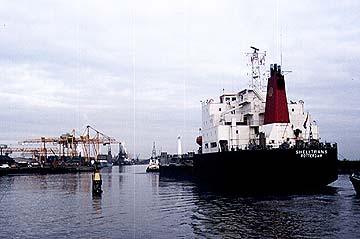
The Manchester Ship Canal.
The ship canal had an enormous influence upon the commercial importance and development of Manchester, which, by the start of the 20th century, ranked as the third port in the kingdom. The Bridgewater canal fed traffic between the docks and inland towns.
The entrance to the ship canal is at Eastham, 19 m. from the bar at the mouth of the river Mersey, and the access is from the sea by way of the lower estuary. The canal skirts the shore of the estuary up to Runcorn, terminating at Trafford Bridge in Manchester. The depth of the canal is 9 m (27 miles), maintained by dredging, and the bottom width, with exceptions for special purposes, is 40 m (120 miles). In its hey-day the docks covered 1400 hectares. By the 1920s Manchester, despite its long history, was essentially modern, and apart from its public buildings, consisted of huge warehouses, offices, and shops. Many of the outlying areas were described as squalid and depressing. Names like Hulme, Ancoats Angel Meadow were still a synonym for slums. The water supply could not be obtained from the Irwell because of its high level of pollution and instead was obtained from the Longdendale Valley and from Thirlmere and Hawes Water in the Lake District.
The decline in the need for the ship canal and the earlier decline in use of the inland canals have caused many great changes in Manchester and Salford. Huge areas of the former docklands have been converted to office, warehousing and homes. Salford Quays is just one of the many transformed areas. Similarly, the River Irwell, once sorely neglected and little more than an open sewer, is now the subject of restoration and areas beside it have been the subject of considerable improvement. |