RIVER CLYDE
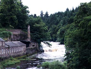
The Clyde Falls, New Lanark.Location: 56N 4E (Scotland); length: 130 kilometres (80 miles); drainage basin: 5600 square kilometres (2200 square miles). The Clyde, the third longest river in Scotland, rises on the flanks of Queensberry Hill (700 m (2300 feet)) and Ballencleuch Law (691 m (2200 feet)) in Dumfriesshire. From the Southern Uplands it flows north, then west through Scotland's largest city, Glasgow, before entering the Irish Sea at the Firth of Clyde, opposite the Isle of Arran.
Upper ClydeThe source of the Clyde is Ballencleuch Law and Queensbury Hill. At first the Clyde flows north east following the grain of the country, but it follows a very curious course, filled with abrupt turns in direction. After flowing north east for a short distance, it changes to flow west near Carstairs, then turns abruptly south before going north again to tumble over the Falls of Clyde. This strange behaviour is caused by the way that the Lower Clyde has captured the headwaters that once belonged to the Tweed, diverting what were once east-flowing streams to flow west. The old route the streams once took is marked by the dry trench (col) in the hills near Biggar.
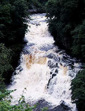
Falls of ClydeThe Clyde is divided into two at Lanark, the Upper Clyde of the Southern Uplands, and the Lower Clyde of the Midland Valley. Both the Upper and Lower Clyde are meandering rivers, but between them there is a remarkable and spectacular connection that has produced the famous Falls of Clyde. The Falls of Clyde region consists of a series of waterfalls set in a narrow gorge above Lanark. Lanark itself sits on a band of hard Old Red Sandstone rock that is resisting the erosion by the Lower Clyde. Above this lie level sheets of shales and sandstones that form the rocks for the waterfalls. The lowest fall is Stoneybyres Fall some 9 m (30 feet) high. 3 kilometres (2 miles) up the gorge is the 27 m (90 feet) high stepped falls at Cirra Linn and above them again the Bonnington Linn Falls. And to guard the route through this narrow gorge lies the spectacular Corehouse Castle situated high on its cliff edge. It was the potential of water power at Corra Linn that attracted Richard Arkwright and David Dale in the 18th century. They captured the water of the Clyde in a tunnel driven through solid rock and used it to power the cotton spinning mills that they built at New Lanark in 1783. When it was built, it was the largest mill in Britain. Here too is the foundation of Robert Owen's planned industrial village. The falls are now partly used for hydro-electric power. At the falls the Upper Clyde is 170 m (560 feet) above the Lower Clyde. This difference is entirely the result of the land rising south of the fault, and the need for the Clyde to cut into the fault edge to maintain its course. Geographers call this a knickpoint.
ClydesdaleClydesdale is that part of the Lower Clyde between Lanark and Hamilton. The uppermost part of Clydesdale sees the river cut a narrow valley into the glacial material that mantles the Midland Valley of Scotland. The steep slopes remain wooded, but the more gentle slopes and terraces are used for orchards and market garden crops. Here open land still abuts the Clyde even though the river terraces are still densely settled and Glasgow looms large. The river valley is part of the important routeway south to England, and Clydesdale is still used by the modern motorway, M74. But the ancient importance of the route is not completely overshadowed by modern development because it is lined with castles.
ClydesideClydeside stretches from Cloch Point just west of Gourock to Glasgow. In this region there is a big contrast between the majestic mountains that lie to the north behind Loch Long and the more modest hills of the south. The city's origins lie around the fording points of the shallow river. Indeed, at low tide, it was possible to walk across the Clyde in the heart of Glasgow with the water only just above the ankles. In the hollow (Howe) flatter land that is now occupied by the vast sprawl of Glasgow, the rocks are masked by deposits of glacial debris. In fact Glasgow is built on an area of hummocky materials called drumlins. The Clyde has marked a path through these low hills and produced parallel benches of flat land, called river terraces. This low lying, forested and marshy site was not attractive to early settlers. The first people to settle at Glasgow were the Romans and they only did this because they were building the nearby Antonine Wall. In the centuries following the departure of the Romans, the road north to Stirling (now High Street) over the river gradually became particularly important. As the city grew away from the river the prominent hills made by the tops of the drumlins were used as sites for the cathedral and university, and also as the core of Victoria Park. Fewer people wanted to be on the floodplain or the lower river terraces, and this is where the poorer areas of the city such as Hutcheson Town and Gorbals regions developed. But although the city grew on trade it could not develop as a port because the river estuary contains bands of raised rock in its bed, called shoals or reefs. This is why, in 1773 the reefs were blown up (see below). Beginning in 1768, a major dredging scheme gradually made Glasgow a port in its own right. The soft glacial materials to either side of the river could be easily excavated to allow some of the world's most important shipbuilding yards to develop along its northern banks (an area called Clydebank). Here the famous ocean liners Queen Elizabeth and Queen Mary were built. Although changes in technology have meant that the old industries have now gone, Glasgow city port still has over 6 m (18 feet) depth of water at low tide and remains a major British port. The town of Dumbarton, just down river from Glasgow, is situated where the Leven River takes the outflow of Loch Lomond (see below) to the Clyde. The Leven was another of the early sites to make use of water power to drive the first textile machinery. Its location is also related to a band of hard rocks (lavas) that form a line stretching south and west from the Campsie Fells through the Kilpatrick Hills and on to the Renfrew Heights. Where the lavas underlie the Clyde, the valley is particularly narrow and the river is very shallow. At Dumbarton a pinnacle of rock is an ancient volcanic pipe (plug) standing up from the mud flats at low tide (similar in shape to the Castle Rock in Edinburgh). It was an excellent defensive spot on which to build a castle that could defend the Clyde from invasion via the Firth of Clyde. The shallow Clyde at Dumbarton includes the infamous Dumuck Ford shoals or reefs. They made navigation difficult for small boats, and as ships got bigger through the centuries, the position of Glasgow as a port became more and more perilous. The shoals were, indeed, the reason that the down river ports of Greenock and Port Glasgow were established and why no docks were at first built at Glasgow. Ocean-going ships berthed at these outports until the reefs were finally blown up in 1773. Greenock marks the western end of the Glasgow conurbation.
Firth of ClydeThe upper Firth of Clyde is the western end of the Midland Valley of Scotland - famous as the second center of population in Britain after London. In fact, the term Midland Valley is misleading because it is not a river valley but rather a rift valley formed by geological faulting. Furthermore it actually contains very little real low lying land. However, it is in the valley that coal seams come to the surface and provide the foundation of growth of the whole Clydeside region. The lower Firth of Clyde is a strange dog-leg shaped complex of drowned valleys (sea lochs) and is, in part, formed by the effects of glaciers flowing south west from the Highlands, and in part by lines of weak rock that mark the Highland Boundary Fault, a natural geological boundary between the Highlands and the Midland Valley of Scotland. The effect of the fault can clearly be seen in some places, for example, the Isle of Bute. The north of the islands is old hard rocks and covered in moorland, while the south is lower. Scalpsie to Rothesay marks the weak rocks of the fault and here you can see a line of small rock basin lakes eroded across the island. The erosion of the Bay on the sheltered eastern side of the islands also allowed the growth of the Victorian town of Rothesay as a seaside resort for the people of Glasgow who took the ferry 'doon the watter'.
Loch LomondLoch Lomond, whose River Leven flows into the Firth of Clyde, forms part of the Trossachs, the so-called Scottish Lake District. It is a lake of unusual shape, being narrow and more like a ribbon lake in the north, yet wide and more like a lowland lake in the south. At its northern end it is 200 m (700 feet) deep and was formed by glacial erosion. It is a true rock basin lake. In the south it is a mere 20 m (70 feet) deep and held up by ridges called moraines and other glacially deposited materials. Loch Lomond's northern 'mountain' section occupies two trenches cut across what were previously lines of mountains before the last Ice Age. The trenches were cut as ice spilled southward from the mountains toward the Clyde. Either side of this part of the lake small former tributary streams are left cascading from valleys hanging high above the valley floor. One of these has been impounded to form Loch Arklet, used for hydro-electric power. Loch Lomond is separated from the sea only by the tops of the moraine that blocks its exit southward. However, its true rocky floor is much deeper. Without the debris Loch Lomond would enter the Forth of Clyde as another sea loch like Loch Long.
Pictures of the Clyde Basin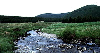
The Southern Uplands headwaters of the Clyde.
|

The lowest of the Clyde Falls, New Lanark, and part of the New Lanark mills.
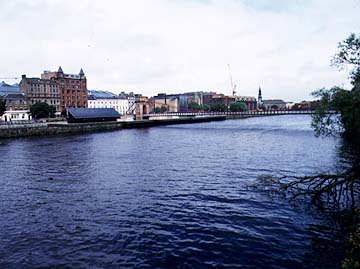
The Clyde at Glasgow.
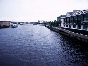
The Clyde at Glasgow.
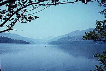
Loch Lomond.


The Clyde at Glasgow.

Loch Lomond.
