|
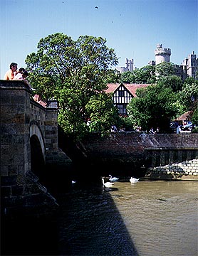
The River Arun at Arundel.The Arun flows southward from near Horsham in Surrey to the English Channel at Littlehampton. The Arun is one of many rivers in South East England to follow a curious course. In flowing southward it cuts across the 'grain' of the land whose hard and soft bands of rock trend from east to west. To understand why this happens we have to go back through geologic time some tens of millions of years. This also helps to show how long a river can exist in a changing landscape. At this ancient time, the bands of hard and soft rock that we see today were not exposed. For example the broad ridge of the South Downs did not stand up as an east-west barrier across the landscape. Instead there was a great dome of land whose center was in the middle of the weald of Kent. Down the flanks of this dome many rivers flowed south to the English Channel. These ancient rivers gradually cut down through the rock that formed the surface of this dome and eventually the cover rock was stripped away by erosion, leaving the rocks exposed as we see today. But by this time the rivers' courses were fixed in the landscape, so the rivers like the Arun simply cut through the soft and hard rocks alike. Geographers know this kind of event as superimposed drainage. The most dramatic town on the Arun is Arundel. Here a massive castle was built. Where the Arun runs through the gorge it has cut through the South Downs. Clearly any invader arriving at the south coast of England would try to move north using this gap and the castle was built to thwart any such invasion. The invasion never happened but the massive castle remains, still dominating the small town that shelters below its walls. Arundel is also a bridging point of the Arun and the highest point that small sailing vessels can reach from the sea.
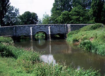
The tributary River Rother just down river from Midhurst. Notice the many arched bridge which is an obstruction to floodwaters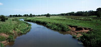
The whole of this part of the Rother valley is wide and flat and prone to flooding. Notice the artificial levees (low grassy ridges or embankments) parallel to the river.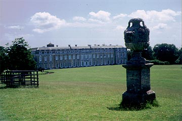
Petworth is one of the most imposing of country houses. Set just to the north of the valley and avoiding the marshy floodplain of the River Rother, its siting on the main road to London offered rural peace and yet good communications.
Because the park was on the northern slopes of the valley, in order to avoid flooding and to enjoy the view, the park attached to the stately home had no natural lakes. This situation was corrected by Capability Brown who engineered a landscape complete with two lakes by damming small streams that flow south to the Rother.
The small town of Arundel planned below one of the most imposing castles in Britain. Almost a fairy tale castle, it has been rebuilt and redesigned to dominate the landscape. It lies just to the west of the Arun gap where the river cuts through the South Downs. In fact the often flooded and marshy gap is devoid of both settlement and roads and even today the main road runs over the crest of the Down rather than using the river route. The gap was thus easy to defend. The Arun is tidal to above Arundel but only navigable for small river craft.
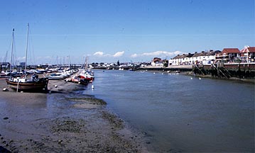
The harbour at Littlehampton. The view looks north with Littlehampton on the right.
The Arun marks the western boundary of the modest seaside resort of Littlehampton. The quay on the right can take small boats, while the small marina on the left is home to a few pleasure craft. The view looks inland across the wide flat coastal plain. In the far distance lies Arundel and the gap cut through the chalk that allows access to London.
|