|
Location: 8S 65W (northern South America); length: 2600 kilometres (1600 miles); drainage basin: 1 million square kilometres (390,000 square miles).
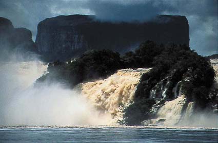
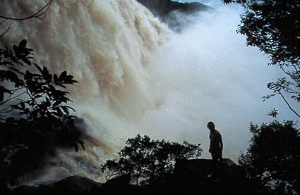
Hacha Falls.
The Orinoco River.
Orinoco, Meta Rivers, Colombia and Venezuela
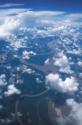
The Orinoco, South America's second longest river extends from right to left across this picture which looks southeast. The river is the eighth longest river in the world.
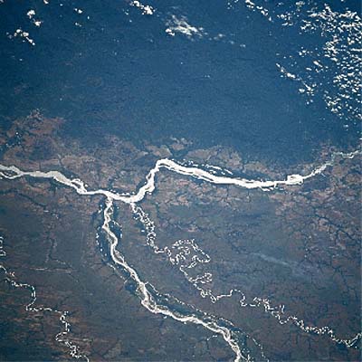
In this scene, the Orinoco skirts the heavily forested Paraguaza Range (upper portion of the image) of the western Guiana Highlands. Entering the scene near the bottom center, the Meta River joins the Orinoco just to the left of center of the image and forms part of the border between Colombia (right or south of the river) and Venezuela (left or north of the river). The small-meandering Bita River is also visible just to the south (right) of the Meta River.
The Orinoco is the major river of northern South America. Its headwaters are in the Sierra Pacaraima in southern Venezuela. On its route to the ocean, the Orinoco makes a huge curve, flowing first west, then north, then east. The main tributaries are the Guaviare and the Meta.
The river is made unnavigable in its upper reaches by several cataracts.
Hacha Falls.
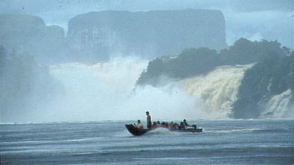
El Sapo Falls.
However, the lower part of the river is an important trade route; Cuidad Bolivar, about 400 kilometres (250 miles) from the mouth of the river, is the highest point of navigation and an important port. Downstream a new city, Ciudad Guyana, has been built beside the river as an industrial city.
Some of the most important goods carried on the river are iron ore and bauxite, both of which are mined in Venezuela. The delta of the Orinoco covers over 20,000 square kilometres (8000 square miles).
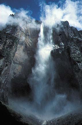
The Angel Falls are on a tributary of the Orinoco. These are the world's highest falls.
|