|
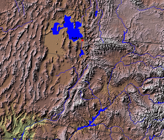
State rivers in their landscape. Notice that rivers broadly flow north or south across the state in line with the mountain ranges. There is also considerable inland drainage to the big salt lakes.
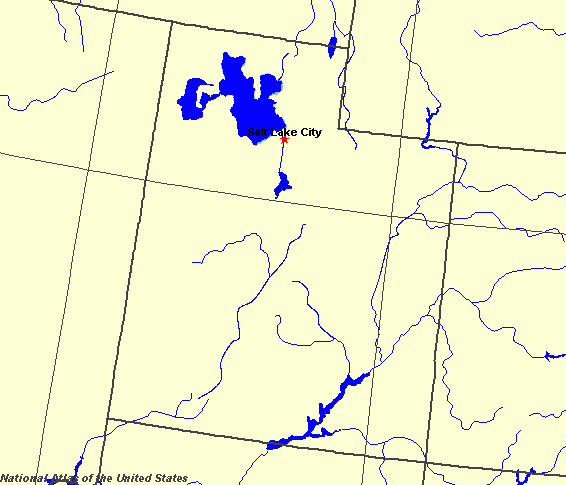
State rivers only. Download and print this to draw watershed boundaries or to put on river names.
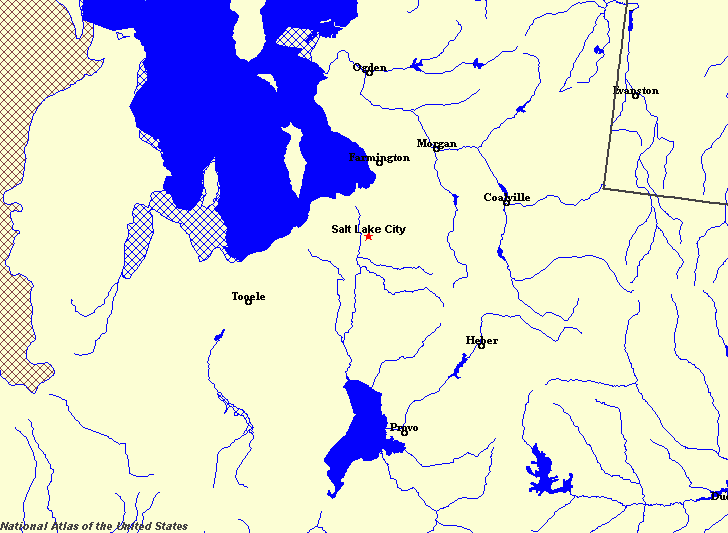
Enlarged view of part of the state river system. You can select other parts and your local area from the National Atlas (see below).
|
|
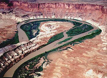
Green River in Canyonlands National Park.
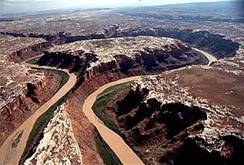
Green River in Canyonlands National Park.Utah (named after the Ute (mountaintop) Indian people) is a middle Rocky Mountain state of the United States. Utah has a great variety of landscapes, dominated by the north-south trending ranges of the Rocky mountains in the east and the Basin and Range in the west. The center includes the inland basins (The Great Basin area) with their salt lakes including the Great Salt Lake. The south is part of the great Colorado plateaulands. The most northerly part of the state is drained by the Snake River . Most of northern Utah, however, is fed by a number of small rivers including Bear River and Weber River that flow from the Wasatch Mountains. They are very seasonal in their flow, being at their peak after spring snowmelt. These rivers eventually drain into the Great Salt Lake and Sevier Lake. Great Salt Lake, is 120 kilometres (80 miles) long and 50 kilometres (30 miles) wide. It varies in size depending on the yearly pattern of rainfall. Its average size is 4600 square kilometres (1800 square miles). It is an extremely salty lake with an average salt content of 20%. The Sevier Lake has a much less reliable flow of water and is mostly dry. Because the Great Salt Lake and Sevier Lake are both areas of inland drainage, no water leaves them except by evaporation, so that the salt is left behind, where it builds up in beds that shine white in the sun. The Colorado and one of its main tributaries, the Green River, drain the eastern and southern part of the state. The Colorado and the Green rivers cut deep canyons into the plateaulands of the south, creating some of the most spectacular river scenery in the world. Part of the Colorado canyon has been flooded by the construction of the Glen Canyon Dam. The reservoir behind it is called Lake Powell. |