|
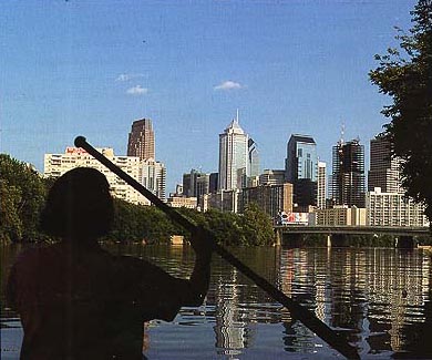
A view over Philadelphia from the Lower Schuylkill. From this you can get a hint of the potential for developing this area into an attractive recreational resource for the city.The Schuylkill River is the main tributary of the Delaware which it enters from the north east. Philadelphia stands at the confluence of the two rivers. The Schuylkill is over 250 kilometres (160 miles) long. In addition to Philadelphia, the cities of Pottsville, Reading, Pottstown, and Norristown stand on its banks. The river has its headwaters in the east and west branches near the town of Tamaqua. The two branches meet and form the Schuylkill at Schuylkill Haven. For much of its natural length the river is wide and shallow and not at all navigable. Many natural fords exist, and some are remembered in the names of places along the river, for example, Parker Ford, about midway along the river. To improve the chances of using the Schuylkill for commercial navigation, the river had to be canalised. The progress of this canalisation resulted in the Schuylkill Navigation. Parts of this historic navigation remain, as at Frick's Lock. The original native American inhabitants of the river basin named the Schuylkill "Ganshowahanna" or "falling waters", after the falls at what is now the Fairmount Water Works Dam west of Philadelphia. The river was first explored by the Dutch in the 17th century. Arendt Corssen named the river 'hidden creek', or 'Schuyl Kil', because at that time the confluence of the river into the Delaware was hidden by swamps.
Improving the tidal Lower SchuylkillOf all of the parts of the Schuylkill that have been most mistreated, the tidal stretch of the river stands out above all others. It was the tidal stretch that was home to numerous factories, warehouses, and wharves during the 19th century years of Philadelphia's industrial growth. But times change, and the river that was once so important for industries that used the water as a means of transport and in their processing, are now gone. Some factories remain, most have been demolished. The result is to leave the lower part of the river as an industrial wasteland. Yet there is considerable potential in the area and numerous historic buildings that could act as the focus for an attractive scenic and cultural area. This has been the goal of the Schuylkill River Development Council, whose impressive plans would result in the development of a riverside park based on the Philadelphia Museum of Art and the Fairmount Water Works. The pictures presented here give an idea of the challenge, the potential and the promise. Look through them and see an example of how vision can turn waste into a benefit to the community.
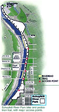
This picture shows the Schuylkill River Park and its location in western Philadelphia.
|