|
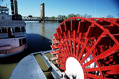
River boats moored at Old Sacramento.
Length: 620 kilometres (380 miles); Basin area: 70,000 square kilometres (27,000 square miles). The Sacramento River (formerly the Rio de San Francisco) has its headwaters in the Klamath Mountains, near volcanic Mt. Shasta. It then flows parallel to the Cascade and Sierra Nevada mountains, occupying the center of the broad, flat Sacramento Valley. It flows past the city of Sacramento before reaching San Francisco Bay to form a common delta with the San Joaquin river. The water from the Sacramento is an extremely important resource for irrigating the crops in the Sacramento Valley because rainfall in summer is very slight. Its flow is controlled and surplus water stored by a number of dams. The river is navigable upstream from the delta for about 400 kilometres (250 miles). Paddle steamers are used on part of the river for tourism. The port was of considerable value during the gold rush days of 1849 when the city of Sacramento was a boom town. It is now the state capital.
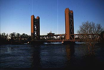
In this picture, you see the Sacramento close to flooding. Notice the small distance between the road bridge and the water surface. Normally boats would easily be able to get underneath the bridge.
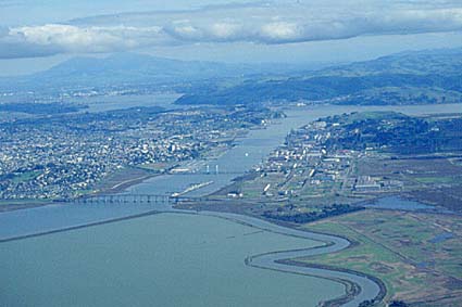
Sacramento delta as it enters San Francisco bay. |