|
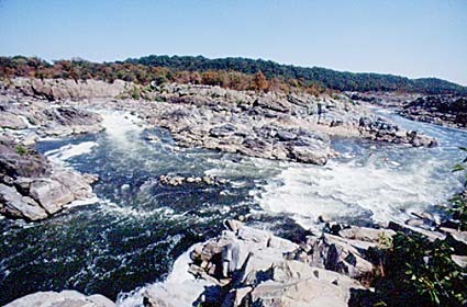
The Great Falls of the Potomac are 11 m (35 feet) high.The Potomac River, first written as Patawomeck by colonist John Smith in 1608, is 700 kilometres (400 miles) long and drains 38,000 square kilometres (14,500 square miles). Tributaries of the Potomac include the Shenandoah, the Monocacy and the Anacostia. The two headwaters of the Potomac begin in the Appalachian Mountains in West Virginia. They meet near Cumberland, Md and then flow southeast, being joined by the Shenadoah at Harper's Ferry and the Anacostia at Washington D.C. The Potomac flows across the northern boundary of Washington D.C. to Chesapeake Bay. The lowest 190 kilometres (120 miles) are tidal.
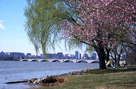
The Potomac near the Jefferson Memorial in Washington D.C.The Potomac makes the boundary between the states of Maryland and Virginia and Maryland and the District of Columbia.
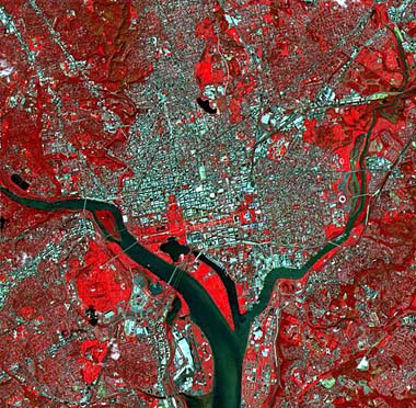
The Potomac as it goes through Washington D.C. shown in false color by satellite. The Capitol and White House can be seen on this picture not far from the river.
The most significant point on the Potomac is at Washington D.C. Here are a series of cataracts (or waterfalls and rapids), of which the largest is the Great Falls of the Potomac. They are all part of the Fall Line that stretches across the Piedmont/Coastal Plain boundary. Below the falls the river is tidal and was accessible by ships. The falls abruptly ended the usefulness of the river for early settlers.
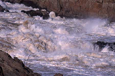
The Great Falls.
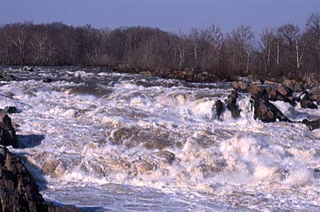
The Great Falls.It was to by-pass the cataracts that the Chesapeake and Ohio Canal was eventually built.
Chesapeake and Ohio canal
The trace of the earliest canal built to bypass the Great Falls.This canal, completed in 1850 from Cumberland, Md., to tidal Georgetown, D.C., just below the Great Falls, stretches alongside the Potomac, from tidal Georgetown just up river of Washington D.C., to the Appalachian coalfield around Cumberland, Maryland. It has 74 locks and a change in height of about 200 m (600 feet). It went out of commercial operation in the 1920s due to competition from the railroad. It is now designated as a National Historic Park. The purpose of the canal was to get barge traffic, and especially their cargoes of coal, through the fast flowing stretches of the river. These occurred each time the Potomac cut through a gap in the Appalachian Mountains, but close to the sea there was also the formidable obstacle of the Great Falls of the Potomac. Building a canal would therefore make access to the coalfields much easier and would also allow the barges to operate through the frequent periods of flood on the river. Although the canal was put out of business on the construction of the railroad, parts of it are still navigable. It also shows splendid engineering achievements, the most remarkable of which are the by-pass around the Great Falls and the 1.6 kilometer (3000 feet)-long Paw Paw tunnel through one of the Appalachian ridges near Cumberland.
The Potomac upstream of the falls.
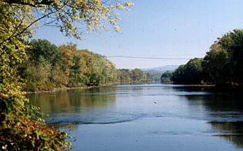
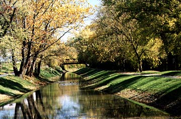
This is the Potomac near Hagerstown.
This part of the Chesapeake and Ohio canal lies close to the Potomac at Hagerstown. |