|
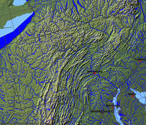
State rivers in their landscape. Notice that the rivers generally run in directions parallel to the main ranges of the Appalachians. There are, however, notable exceptions produced when rivers cut south , creating gaps in the ranges.
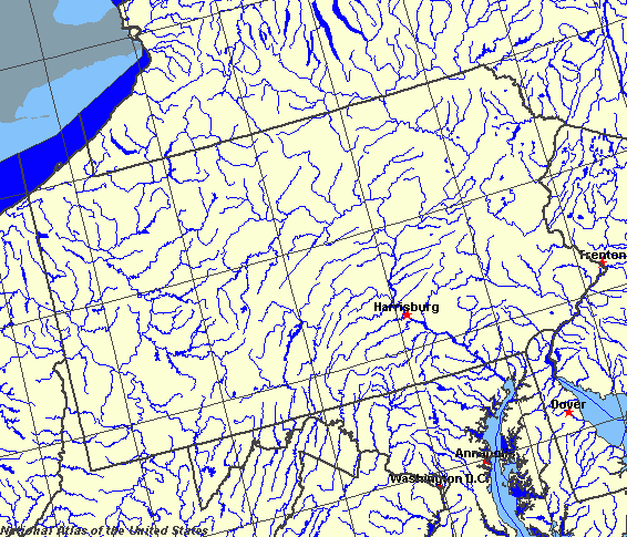
State rivers only. Download and print this to draw watershed boundaries or to put on river names.
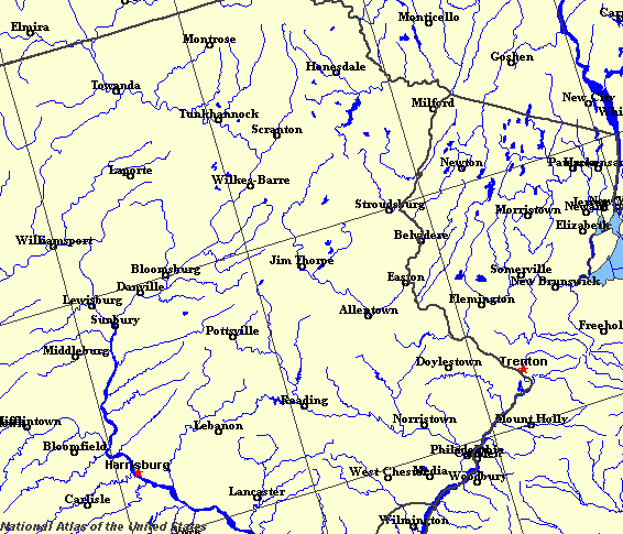
Enlarged view of part of the state river system. You can select other parts and your local area from the National Atlas (see below).
|
|
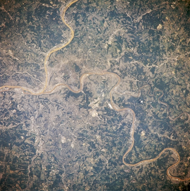
Pittsburgh, Pennsylvania. The built-up metropolitan area that is the city of Pittsburgh is difficult to identify in this image because of the small scale, low spatial resolution, and in fact that most of the residential subdivisions contain vegetative cover that at least partially obscures the urban sprawl that surrounds the downtown core. Downtown Pittsburgh, or the central business district, is located at the apex of the influence of the southwest flowing Allegheny River and the northerly flowing Monongahela River (right center). These two rivers merge to become the Ohio River. Parts of several highway thoroughfares can be traced across the hilly terrain. The light colored, linear roadways include Interstate Highway 279 (left center); Interstate Highway 379 (lower left); US highway 30 (left center); and state Highway 51 (toward upper left center). Residential development and highway orientation patterns have been greatly controlled by the local topography. The darker features of the image show the distribution of the more densely wooded terrain.
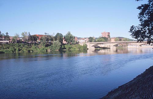
The Allegheny at Warren.
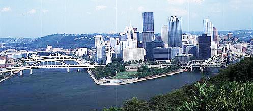
Pittsburgh, the origin of the Ohio. The Allegheney is on the left, the Monongahela on the right and the Ohio in the foreground.
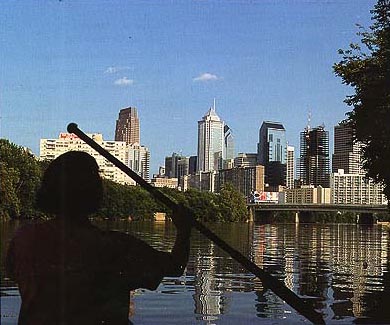
The Schuylkill at Philadelphia.
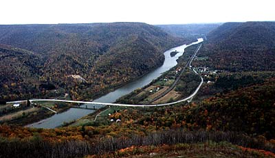
The Susquehanna at Hyner.
Pennsylvania (which means the forestlands of Penn) is a Middle Atlantic state of the United States. Pennsylvania consists of (from west to east) the Great Lakes Plain (Lake Erie), rising to the Appalachian plateau (whose main center is Pittsburgh at the confluence of the Allegheny and the Monongahela), then the ridges and deeply cut valleys of the Allegheny mountains, the Piedmont zone of foothills and finally the coastal plain (with Pennsylvania's largest city, Philadelphia) at the confluence of the Schuylkill and the Delaware. Three main river systems cross the state: the Delaware, the Susquehanna, and the Ohio. The Delaware River makes Pennsylvania's eastern border with New Jersey and flows south into Delaware Bay on the Atlantic Ocean. The Lehigh and Schuylkill rivers are its main tributaries. The Delaware's most prominent feature is the Delaware Water Gap where the Delaware cuts through the ridge and valley lands of the Alleghenies. The Susquehanna River flows through the center of the state, south to Chesapeake Bay. Unlike the Delaware, it is not navigable and has remained largely unindustrialised. Its main tributaries are the West Branch and the Juniata. The Ohio drains the western slopes of the state. The main tributaries are the Allegheny and Monongahela rivers. The Ohio is a tributary of the Mississippi River. Since its improvement for navigation and flood control, the Ohio has become an important commercial river. The largest natural lake is Conneaut Lake, (nearly 400 hectares (1000 acres). The other sizeable water bodies are reservoirs. The Pymatuning Reservoir, on the Pennsylvania-Ohio border, is 7000 hectares (17,000 acres) and Lake Wallenpaupack is nearly 6000 hectares (2400 acres). The high rainfall and snowmelt from the mountains have made the state prone to flooding in the past and several historic disasters, such as at Johnstown in 1889 have plagued people living in the narrow mountain valleys. Many dams have been built on these rivers for flood control purposes and high levees constructed, but the mountain towns are still flood-prone. Case study: The Johnstown disaster Johnstown lies at the east of Pittsburgh. It developed as an industrial town close to coalfields and was an early railroad terminus. Johnstown grew on its steel industry and produced the first American-made steel rails. Johnstown, like many Appalachian towns, lies in the bottom of a steep-sided valley, strung out along a narrow floodplain of the Conemaugh River. At 3.10pm on May 31, 1889, a poorly constructed earth dam above the town on the South Fork gave way after it had become full from heavy rains and the contents of the reservoir rushed down to overwhelm the town. The 10 m (30 feet) wave of water was reported to have flowed at up to 60 kilometres per hour (40 miles per hour). It reached the town at 4.07pm. The 10-m (30-feet) high wall of water smashed into Johnstown. It killed 2209 people and wrecked 1600 homes. The Johnstown Flood National Memorial is located at the site of the old dam. There was another disastrous flood in 1936 and in July 1977 in which 68 people were killed. Flood control has not entirely removed the risk even today. |