|
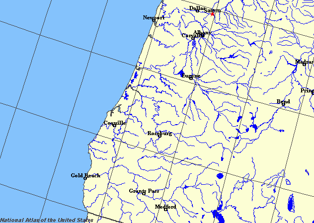
State rivers in their landscape. Notice that rivers broadly flow radially across the state from the main mountain summits.
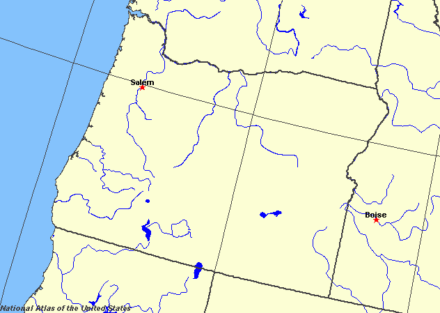
State rivers only. Download and print this to draw watershed boundaries or to put on river names.
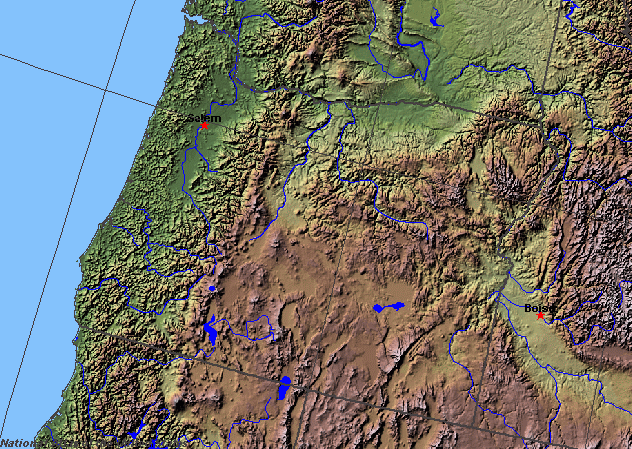
Enlarged view of part of the state river system. You can select other parts and your local area from the National Atlas (see below).
|
|
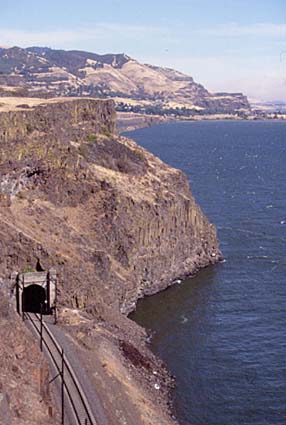
Columbia River near The Dalles.
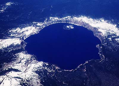
Crater Lake.
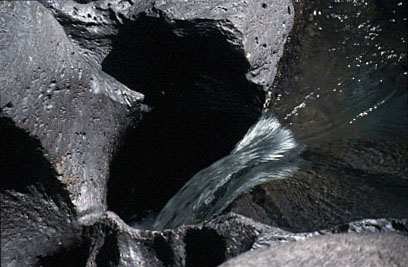
Potholes drilled in the bed of the Rogue River.
Oregon lies in the Pacific Northwest of the United States. It is dominated by broad ranges of mountains including the Cascades with their active volcanoes and part of the Rockies. The largest river in the state is the Columbia (originally named the Oregon river), also the largest river in the northwest. It forms much of the northern boundary of Oregon. The first American to see the Columbia was fur trader Robert gray. He reached the estuary in 1792. Meriwether Lewis and William Clark also saw the estuary of the Columbia during their epic journey in 1805. When the pioneers moved westward in the 1840s, they were often heading along the Oregon Trail for the valley of the Willamette River. The coast of Oregon has many sheltered harbours for small boats and one large harbour at Portland. The estuaries were all formed at the end of the Ice Age when rivers which had been cutting down to a much lower sea level during the Ice Age were rapidly drowned as the ice melted and sea levels rose. Since this time the rivers have deposited a great deal of sediment in their estuaries, with the result that most of the small estuaries are shallow. The Coast Range receives considerable rainfall and its slopes are heavily dissected by small steep mountain streams in deep, steep-sided valleys. All of these valleys are still forested. The main rivers are the Coquille, Umpqua, Siuslaw, Alsea, Yaquina, Siletz, Nestucca, and Nehalem. The Willamette Valley lies to the east of the Coast Range. It is a wide, structural valley whose floor is covered in alluvium deposited by the Willamette River. The eastern side of the Willamette Valley is formed by the Cascade Range. It, too, receives rainfall through much of the year and it has many small rivers cutting steep-sided valleys into its flanks. The remaining two thirds of Oregon lie to the east of the Cascade Range and have much less rainfall. Much of this area is of inland drainage which drain to shallow lakes or dried playas. Two thirds of Oregon is drained by the Columbia River. Its lower reaches are navigable and ships run about 180 kilometres (110 miles) inland. The lower, canalised and regulated part of the river also provides extensive hydroelectricity for the state. The main tributaries in Oregon are the Snake (the main tributary), the Willamette, the Deschutes, and the John Day. The Snake also acts as a border with Idaho. The Snake forms a great arc as it flows around the southern part of the state. It has cut deeply into the plateau lavas over which it flows. At one point it cuts Hell's Canyon, which is deeper than the Grand Canyon in Colorado. The Snake River has cut a canyon deeper than the Grand Canyon of the Colorado but less spectacularly precipitous. Another of Oregon's spectacular rivers is the Rogue River, designated as a wild and scenic river and so not regulated. It cuts deeply into the landscape, creating amazing gorges on its way to the Pacific. Many of the major rivers have been dammed for irrigation, flood control and hydroelectric power. The largest natural lake is Upper Klamath Lake, 370 square kilometres (143 square miles). The most famous lake of the state is Crater Lake, a 600 m (2000 feet) deep circular lake in the top of an active volcanic caldera. |