|
Location: 39N 84W (Central USA); length: 1600 kilometres (1000 miles); drainage basin: 530,000 square kilometres (200,000 square miles) . Tributaries of the Ohio include Allegheny, Kentucky. Monongahela, Tennessee, and the Wabash .

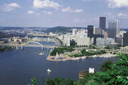
This is Pittsburgh, where the Allegheny and the Monongahela rivers meet at the Golden Triangle close to the city center. You can see the location of the original fort (the white lines just behind the fountain) close to the confluence of the headwaters.
At this point the Ohio is 300 m (1000 feet) above sea level. It drops over 200 m (322 feet) on its journey to its mouth at Cairo.The Ohio is one of the major tributaries of the Mississippi, having, on average, a greater flow at Cairo than either the Missouri or the Upper Mississippi. Gaining its headwaters from the western flanks of the Allegheny Mountains, the river begins at Pittsburgh, where the headwater rivers Allegheny and Monongahela meet. The Ohio then flows broadly south west until it meets the Mississippi at Cairo, Ill. The Ohio River valley was occupied by the French in the early days of colonization. Both knew that the Ohio river valley was the key to westward expansion on the North American continent. Disputes over the land eventually gave rise to the French and Indian War. Later, as settlement proceeded, the Ohio valley was one of the major routes used by pioneers moving into the new lands beyond the Appalachians. The main cities on the river are Pittsburgh, Cincinnati and Cairo. The Ohio is a commercial river, important especially for the movement of bulk building materials and fertilizer. However, many of the Ohio's tributaries are prone to flooding, especially in the winter and spring, while the whole river system is prone to summer drought. The Tennessee was a particular problem and its severe flood and erosion problems were dealt with by the establishment of the Tennessee Valley Authority. Nevertheless, to aid navigation in times of summer drought, and to control flooding, the Ohio also has numerous locks. Pollution is a severe problem that arises on all rivers that flow through industrial regions. As early as 1948, the Ohio River Valley Water Sanitation Commission was formed to oversee population control.
Control of the OhioThe Ohio is a steeply sloping river which was historically liable to major floods from snowmelt and summer thunderstorms and also summer and winter drought. At Louisville, Kentucky there are important rapids as the Ohio falls 8 m (24 feet) in 4 kilometres (2.5 miles) over a series of limestone ledges (this is known as the Falls of the Ohio). A combination of rapids and rapid changes in river level made canalisation a priority. Most of the canalisation was completed in the first quarter of the 20th century, the 46 locks and dams providing a 3 m (9 feet) deep navigation channel. The river navigation has since been completely overhauled and the number of dams reduced to make the navigable channel deeper and the number of locks that have to be passed through smaller. All of these improvements have led to an increase in the river traffic. However, flooding is not completely controlled and much of the river has the additional protection of levees. These are most dramatic at Cairo, where the levees on the Mississippi and the Ohio meet to make the city look as though it is fortified.

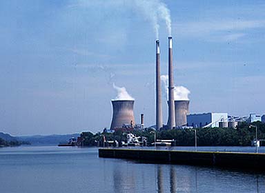
This part of the Ohio forms the border between the states of Ohio and W Virginia. The river is used for the bulk carrying of cargo, including fuel for the riverside power plants. The power plants also make use of the river as a source of cooling water.
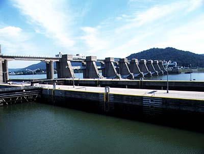
The Ohio is now canalised, turning a shallow river of little use for navigation into one of the most important commercial waterways in the United States. This is a picture of the locks and barrage at Hannibal.TributariesThe main headwater tributaries are the Allegheny (500 kilometres (330 miles) and the Monongahela (480 kilometres (300 miles).

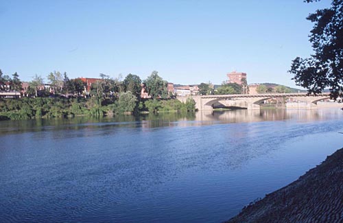
The Allegheny at Warren, Pennsylvania.The Allegheny flows from northern Pennsylvania mainly south west toward Pittsburgh. The Monongahela flows from West Virginia (close to the headwaters of the Potomac) and then flows north toward Pittsburgh. The main northern tributaries of the Ohio below Pittsburgh are the Beaver River in Pennsylvania; the Muskingum, Hocking, Scioto, and Little and Great Miami rivers in Ohio; and the Wabash River. The main southern tributaries are the Great Kanawha and Guyandot rivers in West Virginia; the Big Sandy River; and the Licking, Kentucky, Salt, Green, Cumberland, and Tennessee rivers in Kentucky.
HistoryThe name Ohio comes from the Iroquois language, meaning bright or beautiful. The first French exploration of the river may have been as early as 1669, but it was only in 1749 that French control was established. In 1754 they built Fort Duquesne at the confluence of the Allegheny and Monongahela. After a struggle for power, the British took over control in 1758 and replaced the French name with their own, naming it Fort Pitt, and establishing the name of the city that grew next to it. By 1783 the river was part of the new United States. It soon became a major thoroughfare for settlers moving west. Despite the floods and droughts, steamboats plied the river in the 19th century. But the arrival of the railroad made it difficult for river traffic to flourish until it was canalised in the 20th century. The Ohio from Pittsburgh to Portsmouth, Ohio, was traditionally one of the great manufacturing centers of the United States, concentrating on iron and steel making and the fabrication of all manner of metal goods. It is also one of the areas to have undergone a major transformation in recent years, shedding much employment in heavy industries and gaining it in more office-based jobs. By contrast, below Portsmouth the river is almost entirely rural and has undergone no major changes. |