|
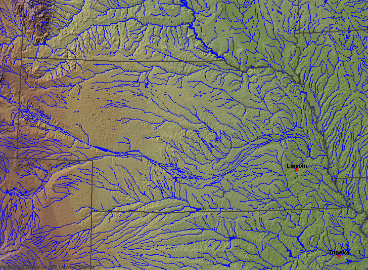
State rivers in their landscape. Notice that rivers broadly flow east across the state from the Rockies.
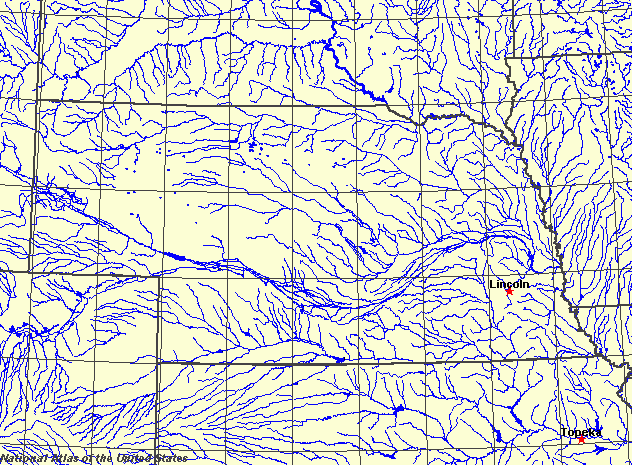
State rivers only. Download and print this to draw watershed boundaries or to put on river names.
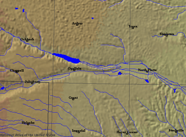
Enlarged view of part of the state river system. You can select other parts and your local area from the National Atlas (see below).
|
|
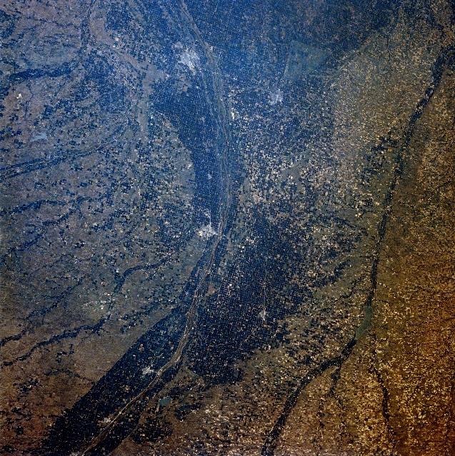
Central Nebraska. The dark agricultural lands of the Platte River Valley are apparent in this west-looking, low-oblique photograph. The Platte River flood plain in this region is more than 10 miles (16 kilometres) wide. Kearney (near the center) is a commercial, industrial, and transportation center in this agricultural area. Products include farm and irrigation equipment. Near the present city of Kearney, Fort Kearney was established in 1848 to protect settlers moving westward on the Oregon Trail; the fort was abandoned in 1871. East of Kearney on the Wood River near its junction with the Platte River is Grand Island, a major manufacturing and shipping center for this livestock, grain, and dairy region of central Nebraska. South of Grand Island is Hastings (barely discernible). Visible to the south of the Platte are the Republican River, and to the north are portions of the Sand Hills.Nebraska (whose name means flat water) lies to the west of the Missouri River, for the most part occupying land that is part of the Great Plains that slope gently westward to the Rocky Mountains. Much of this land has been affected by ice sheets spreading down from Canada during the last Ice Age. The results of glacial deposition have been to produce a landscape of rolling glacial hills. The entire state drains to the Missouri River. The main rivers of the state are the North Platte and the South Platte, both of which have their headwaters in the Front Range of the Rockies in Colorado, but which meet in Nebraska to form the Platte River. The Platte flows almost directly westward through the center of the state to reach the Missouri at Plattsmouth, just south of Omaha. Tributaries of the Platte also all flow south and eastward following the general slope of the plains and gradually converging with the main river. They include the Elkhorn, which drains a large area called the Sand Hills in the north of the state, and the Loup. Rivers to the south of the Platte do not drain to the Platte, but south and west to enter the Missouri directly. These include the Republican and the Blue. As the rivers flow over this large semi-arid and treeless plainland, so they cut wide shallow trenches, with broad, sandy floodplains and steep, canyon-like sides. The Platte has always provided the main artery across the state since the time of the first pioneers trecking along the Oregon Trail. They followed what they described as The Great River Road, referring to the wide and flat floodplain of the river that made their journey so much easier. They also described the Platte as being an inch deep and a mile wide, a reference to the braided character of the river. The river floods each spring as snow melts on the Rockies. It is also liable to flood after summer rainstorms. The objective of the people on the Oregon Trail was therefore to avoid both of these treacherous times as best they could. In the glaciated north there are many small natural lakes filling in the hollows between the glacial hills. In the south the lakes are all artificial and designed as flood prevention reservoirs. They also provide valuable irrigation water to this parched land and relieve the demand on extracting water from the aquifers that underlie the state and which are being over exploited. The largest reservoir is 30 kilometres (20 miles) long Lake McConaughy, on the North Platte Valley near Ogallala. There are extensive underground supplies of water in the state. A huge sandstone and limestone aquifer stretches parallel to the Front Range south beyond Colorado to New Mexico. It is called the Ogallala aquifer. |