|

Location: 40N 90W (USA); length: 3800 kilometres (2300 miles); drainage basin: 3.2 million square kilometres (1.2 million square miles). Combined Mississippi/Missouri system length: 6000 kilometres (3700 miles). Video: The Mississippi at St Anthony Falls, Minneapolis/St Paul.
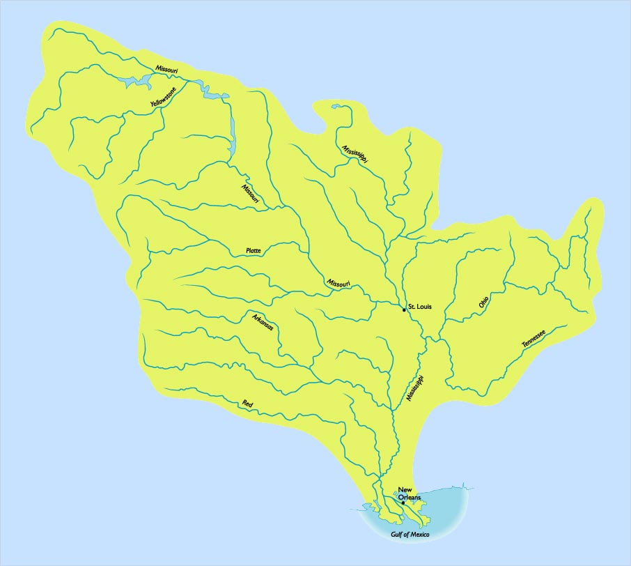
The Mississippi Basin (map from The River Book, search River.
The Mississippi looking toward the Gulf of Mexico.
The Mississippi, whose name in Algonquian means 'father of waters' is the third largest river system in the world (even without the Missouri) and covers about forty per cent of the U.S. Together with the Missouri it drains almost all the continental U.S. between the Rockies and the Appalachians. The headwaters of the Mississippi are in Lake Itasca, Minnesota to the west of Lake Superior. The river then follows an almost directly south route.
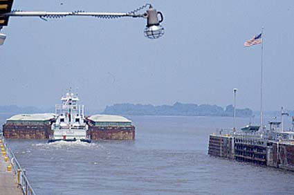
Lock 24 above St Louis.
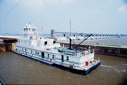
Lock 24 above St Louis.Its main tributaries are the Missouri (which joins at St. Louis and adds a fifth to the flow of the river), the Ohio (which joins at Cairo) and the Arkansas (which joins above Greenville, Miss.).
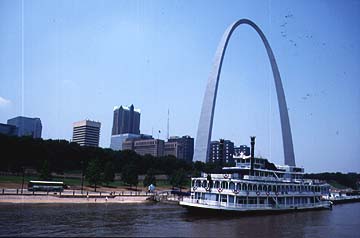
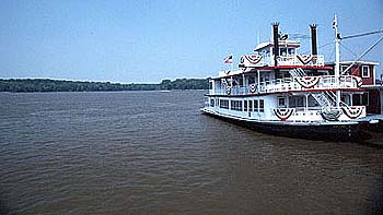
St Louis, the gateway city to the west, showing a traditional paddle steamer in front of Gateway Arch, a memorial to the days of the pioneers who disembarked here and prepared to follow the Oregon Trail.The reach of the river below Cairo is notable for the way that the river makes exaggerated meanders, looping back and forth over a floodplain up to 100 kilometres (60 miles) wide.
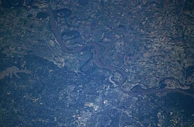
The city of Memphis is visible in this west-looking view. Notice the meanders and cutoffs along the river.
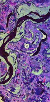
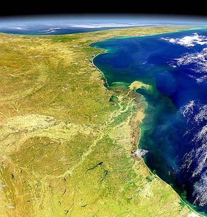
Cutoffs and oxbows show clearly in this false color picture from a satelliteIn this stretch of the river there are many natural levees along both banks. Here the river bed is often higher than the floodplain on either side, with the consequence that any breaches in the levees result in severe and widespread flooding. The Mississippi makes a huge 'bird's foot' shaped delta covering some 26,000 square kilometres (10,000 square miles) as it deposits sediment in the Gulf of Mexico. The Mississippi delta grows outward by up to 100 m (300 feet) a year.
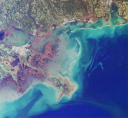
The Mississippi delta, showing the sediment plume that emerges into the Gulf of Mexico.There are many cities along the river, including Minneapolis St Paul (MN), St. Louis (MO), Cairo (IL), Memphis (TN), and Baton Rouge and New Orleans (MI) (both in LA). Each of these cities, as well as the huge area of valuable farmland, need flood protection measures.
New Orleans near the Mississippi delta, protected by its high levees.The Mississippi has always been an important routeway across the North American continent. Trade between the Indian nations was well established up and down the Mississippi valley long before Europeans arrived. It was obvious to the French, who colonized the Mississippi, and the British, whose territory extended to the Mississippi headwater rivers, that this was a prize worth defending. During the great westward migrations, more people chose to sail down the coast of the U.S., and then up the Mississippi before making their westward trek, than ever made the overland journey from the east coast. The problem with navigation on the river has been that it is wide and shallow and the river contains numerous shoals which are a hazard to navigation. The shallowness of the river was the reason the paddle steamers were in use on the river as soon as powered ships were developed; paddle-driven ships need less draft than propeller-driven ships. The lower reaches also have huge meanders that make the journey seem frustratingly long to the ship and barge owners.
The famous paddle steamers of the Mississippi were a response to the frequent natural shoals that plague the river.In various attempts to improve the navigation, the U.S. Corps of Engineers has put in place numerous schemes, the most dramatic of which was the scheme to cut through several meander loops near Greenville, Miss. to reduce the channel length. Other schemes involved making the river scour its bed by adding training walls that forced the river into a narrower channel and so increased the flow. The problem that has been encountered throughout these attempts is that the river is so huge, and its response times so long, that it is not clear what the effects of alterations are until years after they have been made. Certainly many of the schemes have had no long term benefits. For example, increasing the flow of the river simply made it harder for barge owners to get their vessels upstream, cutting off loops in one area just caused more sedimentation elsewhere. At present the river still has to be dredged, and simply moving the sediment to keep the channel clear for navigation has created the world's biggest ever civil engineering works. Despite all these problems, the 24,000 kilometres (15,000 miles) of navigable Mississippi system remains an extremely important commercial waterway for the transport of bulk goods such as building materials, grain, petroleum and ore.
The use of the logos on top of this page were authorized by Mississippi River Parkway Commission |