|
State rivers in their landscape. Notice that rivers broadly flow to the Atlantic across the eastern part of the state, but follow the curves of the Appalachian hills in the west, except where they cut gaps .
State rivers only. Download and print this to draw watershed boundaries or to put on river names.
|
|
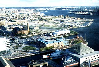
Baltimore near the head of Chesapeake Bay.
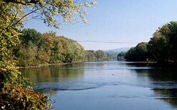
The Potomac, near Paw Paw below Cumberland.
Maryland stretches from the Appalachian Mountains through the Piedmont Plateau to the Atlantic Coastal Plain. The Blue Ridge, Catoctin, and Allegheny mountains form the source regions of many of the streams and rivers that flow to the sea. The largest river in the state is the Susquehanna, which bisects Chesapeake Bay, its drowned lower valley or estuary. The westernmost part of the state drains to the Mississippi. However, nearly all the rivers that originate in Maryland are tributaries of the Potomac, which forms the boundary with Virginia and drains into the southern part of Chesapeake Bay. The main rivers tributary to the Potomac in Maryland are the Monocacy River and the Conoccocheague, Antietam, and Catoctin creeks. The major Appalachian valley in Maryland is the Hagerstown valley. When the rivers leave the ridges and valleys of the Appalachians, they enter the broad, rolling Piedmont Plateau. Most of the rivers are entrenched into the valley, and most leave the plateau in spectacular waterfalls along the line known as the Fall Line. The Falls of the Potomac, just outside Washington D.C., is the most spectacular example. Several efforts were made to make the Potomac navigable beyond the Great Falls of the Potomac. These attempts are celebrated in the Chesapeake and Ohio Canal National Historic Park that lines both banks at the falls. Much of the canals still remain.
The Potomac has been of critical importance to Maryland because it provided a way of moving inland at least as far as the Fall Line. Several rivers drain directly into Chesapeake Bay. They are the Patuxent, the Patapsco, the Gunpowder, the Elk, Sassafras, Chester, Wye, Choptank, Nanticoke, Wicomico, and Manokinohave. All of these rivers were settled from earliest colonial times. Chesapeake Bay has been of particular importance to Maryland because of its central position in the state and because of the many kinds of livelihood it provided. Chesapeake Bay is the largest estuary in the United States and one of the world's greatest inshore fishing grounds. The bay is about 300 kilometres (180 miles) long and up to 50 kilometres (30 miles) wide, giving a shoreline of 6500 kilometres (4000 miles). The drainage basins flowing into the bay drain some 190,000 square kilometres (74,000 square miles). Of particular historic significance is St Marys City, the original site of settlement chosen because of the shelter provided by Chesapeake Bay. |