|
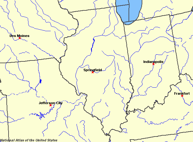
State rivers in their landscape. Notice that rivers broadly flow south to join the Mississippi, even those close to the Great Lakes.
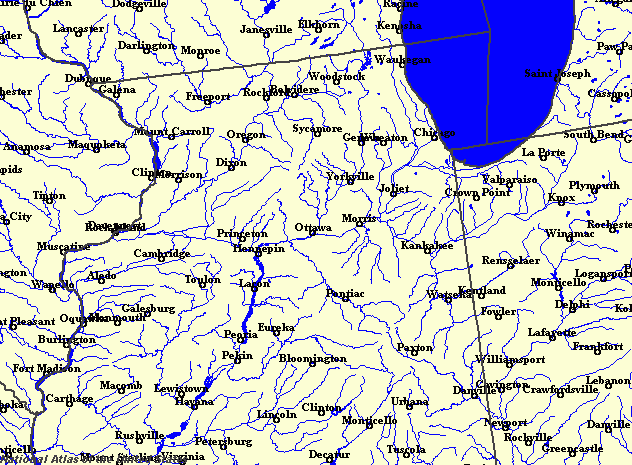
State rivers only. Download and print this to draw watershed boundaries or to put on river names.
Enlarged view of part of the state river system. You can select other parts and your local area from the National Atlas (see below).
|
|
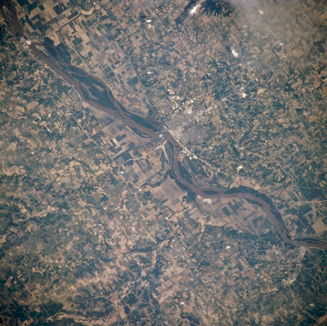
Mississippi River and Quincy, Illinois, U.S.A. Featured in this northeast-looking, low-oblique photograph is the portion of the Mississippi River between Canton and Hannibal, Missouri. Atop a bluff on the eastern shore of the river is Quincy, Illinois (near center), a trade, industrial, and distribution center in a grain and livestock producing area. The city has a good harbour and was an important river port in the mid-19th century. Hannibal, Missouri (near bottom right), the boyhood home of author Mark Twain, sits on the western shore of the Mississippi River.Illinois stretches between the Great Lakes and the headwaters of the Mississippi. The Mississippi marks the western boundary, the Wabash the eastern boundary and Lake Michigan the north-eastern boundary. The Illinois River flows diagonally through the middle. The landscape is gently undulating, dominated by spreads of glacial debris mantling old level rocks. As a result there are no spectacular gorges, rapids or waterfalls and many people pass from one drainage basin to the next without really noticing. Nonetheless, there are seven drainage basins in the state: the Lake Michigan basin contains the lake and the small rivers that drain directly into it. All of the others are named for their largest rivers: the Illinois basin; the Rock basin; the Kaskaskia basin; the Big Muddy basin; the Wabash basin; and the Ohio basin. The biggest river (other than the Mississippi which forms the western boundary of the state) is the Illinois, 400 kilometres (250 miles) long. This river flows southwestward and joins the Mississippi just north of St Louis. A canal connects the headwaters of the Illinois with Lake Michigan, thus providing a throughway for barges between the Great Lakes and the Mississippi. The Illinois has been dammed in many places both to provide water supply and recreational water and to help in navigation. The Illinois Waterway connects Lake Michigan via the Chicago, Des Plaines and Illinois Rivers with the Mississippi over a distance of 525 kilometres (325 miles). It was opened in 1933. It was not the first canal, the Illinois and Michigan Canal being opened in 1849, together with earlier dams and locks built on the Illinois River in the late 19th century. It provides a waterway with a minimum depth of 3 m (9 feet). To achieve this water is diverted from Lake Michigan. The Chicago River has been reversed, so that it now flows out of the lake, where previously it flowed into it. A canal (originally the Chicago Sanitary and Ship Canal, whose purpose was to get sewage to flow away from Lake Michigan) then joins the Chicago and Des Plaines rivers. Over the length of the waterway there are just seven locks to negotiate a fall of 50 m (160 feet). |