|
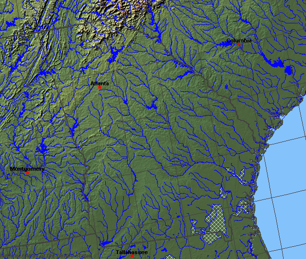
State rivers in their landscape. Notice that rivers broadly flow east or west across the state. Rivers in the west flow south and southeast from the Appalachians.
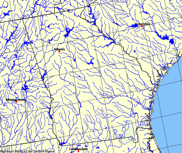
State rivers only. Download and print this to draw watershed boundaries or to put on river names.
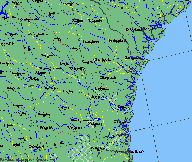
Enlarged view of part of the state river system. You can select other parts and your local area from the National Atlas (see below).
|
|
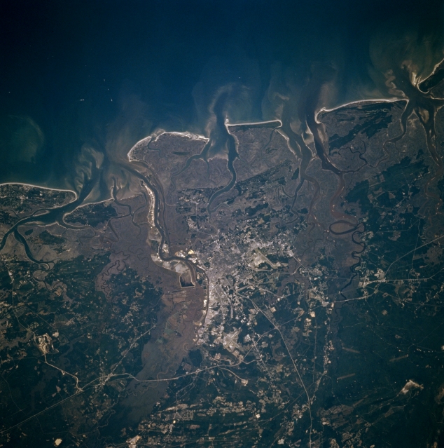
The dockside at Savannah
Georgia lies across the Appalachian Mountains and mountains cover over a quarter of the state. Rivers flow from these high ridges both to the Atlantic and to the Gulf of Mexico. The northern border with South Carolina is formed by the Savannah River. The southwestern border with Alabama is formed by the Chattahoochee River. On the east there is the coastal plain. This flat land contains a large number of small ponds and swamps. The largest swamp is the huge Okefenokee swamp on the border with Florida. Away from the coast the land gradually rises toward the Appalachian Highland via the Piedmont Plateau. The boundary between the plains and plateau is marked by the Fall Line, a long scarp that extends from the Gulf right up to New England. Here rivers flow swiftly as they drop height quickly. In many cases the Fall Line is marked by waterfalls, and in all cases the Fall Line marks the head of navigation of the rivers and was the site for many towns. The swift flow of the rivers across the Fall Line was also marked by the location of many early factories, using the power of the water. To the west of the Piedmont lies the high Appalachian summits, forming the watershed between Atlantic and Gulf rivers. The main rivers that flow to the Atlantic are the Savannah, Ogeechee, Altamaha, Satilla, and St. Marys. The rivers flowing to the Gulf are the Chattahoochee, Coosa, Flint, and Suwanee (which flows through Florida). There are no large lakes in Georgia, although there are many small lakes in the north of the state. The western part of the state is underlain by hard rocks of the Appalachian Mountains and there are no aquifers. Partly as a result, many reservoirs have been formed in the mountain valleys. There are several important reservoirs whose waters are used for irrigation and hydro-electric power. They are Clark Hill Reservoir (Augusta), Walter F. George Lake (Fort Gaines), and Lake Sidney Lanier (Piedmont Plateau). Limestone bands underly the eastern coastal region and here groundwater can be used for water supplies.
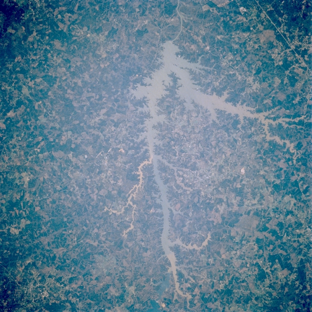
Clark Hill Reservoir, Georgia, U.S.A. Clark Hill Reservoir, one of the largest reservoirs on the Savannah River, lies northwest of Augusta and forms part of the Georgia-South Carolina border. The lake, surrounded by light-colored forested lands, receives sediment from numerous tributary streams. Thin, linear Interstate Highway 20 is apparent south of the lake (right corner).
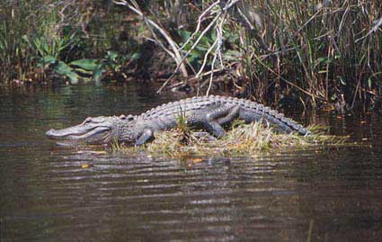
Okefenokee swampland
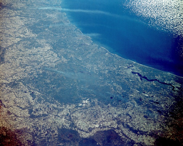
The Okefenokee Swamp Region, Georgia and Florida, U.S.A. This northeast-looking, low-oblique photograph shows the Okefenokee Swamp (dark greenish-blue area near the center of the photograph) and the Atlantic Coastal Plain of southeastern Georgia and northern Florida. The Okefenokee Swamp is considered a deciduous forest, or bottom hardwood swamp, in a coastal basin that is flooded annually by slow-moving streams. The Suwannee River rises and is the main river or stream in the swamp. The Okefenokee Swamp is 40 miles (64 kilometres) long, averages 20 miles (32 kilometres) in width, and covers 600 square miles (1555 square kilometres). The swamp sits in a saucer-shaped depression with low ridges and small islands rising above the water and vegetation cover. Tall bald cypress trees, relatives of the California redwoods, provide a rich habitat for numerous species of wildlife and a host of epiphytic and climbing plants. This type of cypress swamp depends for its survival on periodic fires, as well as water. White smoke plumes are scattered throughout the swamp area. Jacksonville, Florida, at the north end of the Saint Johns River, can be seen to the east-southeast of the Okefenokee Swamp area. The barrier islands along the southeastern Georgia coast are visible to the east and northeast of the swamp region.(NASA>)/h6> |