|
To get a larger view of the maps below, click HERE
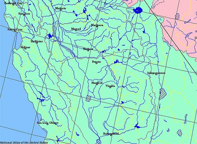
State rivers in their landscape.
State rivers only. Download and print this to draw watershed boundaries or to put on river names.
Watersheds of the Redding area.
Watersheds of the San Francisco area.
Watersheds of the Bakersfield area.
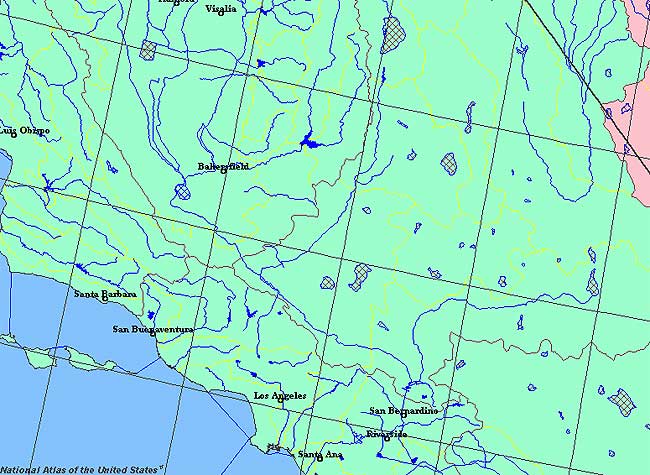
Watersheds of the Los Angeles area.
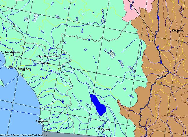
Watersheds of the San Diego area.
The relief and rivers the Central Valley.
The relief and rivers the Yosemite area.
You can make your own maps from the National Atlas (see below).
|
|
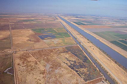
Aqueducts in central California.
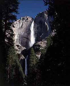
Yosemite Falls in the Sierra Nevada.
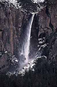
Bridalveil Falls, Yosemite in the Sierra Nevada.
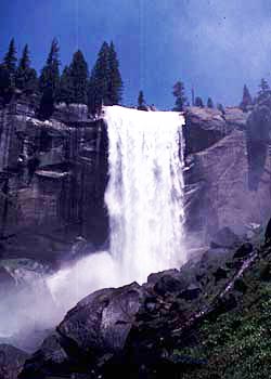
Nevada Falls, Yosemite in the Sierra Nevada.
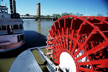
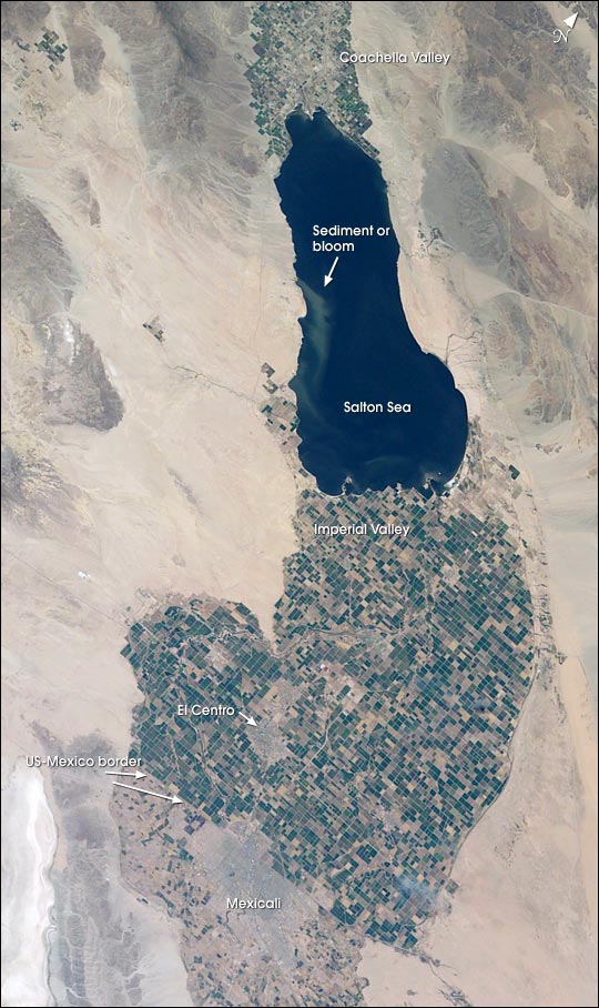
Sacramento River.California is a state of extreme contrasts. Its eastern mountains and valleys are desert lands, while its western mountains are much better watered, The northern part of the state experiences the passage of depressions and the bands of rain and sometimes snow that they bring, while the south sees rain on only a few days each year. The varied landscape, too, causes the rivers to be very different in one place to another. The rugged Sierra Nevadas and other ranges have torrential streams, often fed by melting snow in the spring, while the rivers that flow in the inland valleys are slow moving and meander in wide curves. The northern part of California is drained by the Klamath, Mad, Eel, Russian and the Sacramento Rivers. The Sacramento is the most southerly of these. Its passage through the Central Valley and its confluence with the San Joaquin River provide the major river system of the state. They drain to San Francisco Bay, creating a large delta. The San Joaquin drains some of the most well known tourist rivers of the state: the Stanislaus, Tuolumne, and Merced, all of whose headwaters are familiar to those visiting Yosemite National Park and nearby national Forests in the Sierra Nevadas. The rivers in the south have much less regular flows than those in the north, being typical of semi-arid and desert conditions. While dry for much of the year, local thunderstorms can see torrential rain turn into flash floods. The huge storm drains that thread Los Angeles like some unused super-highway system point to the efficiency of these life-threatening floods. The most southerly river in California is the Colorado, which forms part of the boundary of the state before emptying into the Pacific at Baha California. This is also the state's most regulated river, with huge amounts of water abstracted for irrigation and city water supplies. California has some of the world's longest canals, built to distribute water from its rivers to its centers of population, especially the vast metropolis of Los Angeles in its near desert coastal location. The main lakes are in the Sierra Nevada and include Lake Tahoe, on the California Nevada border. However, the largest lake is the Salton Sea in the south, lying in Imperial valley. This is a brackish lake, quite unsuitable as a supply of drinking water. Many of the largest stretches of water are now reservoirs built to store runoff for use by farms and cities and to provide hydro-electric power and flood control. California's aqueducts Because there is so much demand for water from the farms of the desert valleys and the coastal cities, California has developed one of the largest aqueduct systems in the world. The Los Angeles River was able to supply this city for only a short part of its history and demand soon outstripped supply. This was all the more so because the Los Angeles River has an unreliable flow. Next the city turned to groundwater, but, by 1908 this, too was on the point of over exploitation. Los Angelinos started looking at the rivers that flowed from the Sierra Nevadas. The closest of these was the Owens River that flows east of the highest ranges of the Sierras. An aqueduct was built to tap this water and it started to feed into the city in 1913. It is about 350 kilometres (215 miles) long. Most of it (250 kilometres (155 miles)) is in a covered tunnel, but 100 kilometres (60 miles) is in a canal. The aqueduct has a reservoir part way along its course that can hold enough water to keep the aqueduct flowing at full capacity for 80 days. This aqueduct only lasted for 10 years until its was fully utilized and more water was needed. At this point attention turned to the Colorado River, less attractive because of its heavy silt content and powerful flow. It is also 500 kilometres (300 miles) from Los Angeles. The construction of the Hoover Dam in the 1920s regulated the Colorado, trapped the silt and allowed abstractions of clear water. However, a further reservoir was needed to ensure reliable supplies. The Parker Dam creates a lake on the Colorado that supplies the water for the Colorado River Aqueduct. To get the water to Los Angeles five pumping plants are needed to get the water up from Parker to Lake Matthews, after which gravity carries the water to the city. 150 kilometres (95 miles) of tunnels had to be drilled through mountain ranges as part of this scheme. The aqueduct was opened in 1941. Of course, Los Angeles was not the only water-hungry city and on construction of the Parker Dam, enough water was available to split the supply between Los Angeles and San Diego. This system still will not provide enough water to match demand and canals have had to be built to divert water from the north of the state to the south. This is the California Aqueduct, some 720 kilometres (450 miles) long, leading from the Sacramento through the Tehachapi Mountains to a reservoir between Los Angeles and San Diego.
Salton Sea.
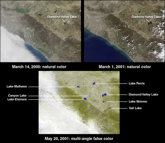
The new Diamond Valley Lake Reservoir near the city of Hemet in Riverside County is billed as the largest earthworks construction project in U.S. history. Construction began in 1995 and involved 31 million cubic m of foundation excavation and 84 million cubic m of embankment construction. At the upper left is a natural-color view acquired by the instrument's vertical-viewing (nadir) camera on March 14, 2000, shortly after the Metropolitan Water District began filling the reservoir with water from the Colorado River and Northern California. Water appears darker than the surrounding land. The image at the upper right was acquired nearly one year later on March 1, 2001, and shows a clear increase in the reservoir's water content. When full, the lake will hold nearly a trillion liters of water.
|