|
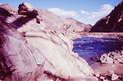
The Arkansas in the Sangre de Cristo Mountains.Length 2300 kilometres (1500 miles); basin area 414.000 square kilometres (160,000 square miles) The main cities on the Arkansas are: Pueblo, Colorado; Wichita, Kansas; Tulsa, Oklahoma; and Fort Smith and Little Rock, Arkansas. The Arkansas River is one of the major tributaries of the Mississippi. It begins near Leadville in Lake County, high in the Sawatch Range of the Colorado Rockies, then generally flows southeastward through Kansas, Oklahoma, and Arkansas. It joins the Mississippi 60 kilometres (40 miles) north of Arkansas City. During its journey, water from the headwaters falls nearly 3500 m (11,500 feet). The passage of the Arkansas through the Rocky Mountains gives rise to much dramatic scenery. In the first 160 kilometres (100 miles) the river flows south to Canon City, dropping over 2000 m (6800 feet). At Canon City it has cut the Royal Gorge, a narrow canyon cut into granite and metamorphic rocks. The first major tributary of the Arkansas is the Purgatoire, noted for it flash floods. Below the confluence lies the John Martin Reservoir, near Las Animas, Colorado. This reservoir was designed in part to curb the flooding caused by the unruly headwaters. Having passed Las Animas, the river flows out onto the east Colorado plains near Pueblo, flowing less swiftly and following a more meandering course until it reaches Great Bend, Kansas. This is also the most arid stretch of the river, as it lies in the rainshadow of the Rockies. South east from Great Bend, the river flows into countryside that experiences moist warm air from the Gulf of Mexico and the land is no longer arid. But the arid land upriver has given the river a bed of sand and gravel so that the channel is shallow and wide. In Oklahoma the Salt Fork, Cimarron, Verdigris, Grand, and Canadian rivers join the Arkansas. This lower section of the Arkansas is controlled by a number of reservoirs, so that the farms along its banks can receive irrigation water. Arkansas River Navigation System, (McClellan-Kerr Arkansas River Navigation Systems) is responsible for improved navigation of the lower third of the Arkansas basin, namely parts of the Verdigris and Arkansas rivers. The seventeen dams and locks along the waterway, create a channel 75 m (250 feet) wide and 3 m (9 feet) and also generate hydroelectric power. Major reservoirs include the Keystone in Oklahoma, and the Dardanelle in Arkansas. |