|
State rivers in their landscape.
State rivers only. Download and print this to draw watershed boundaries or to put on river names.
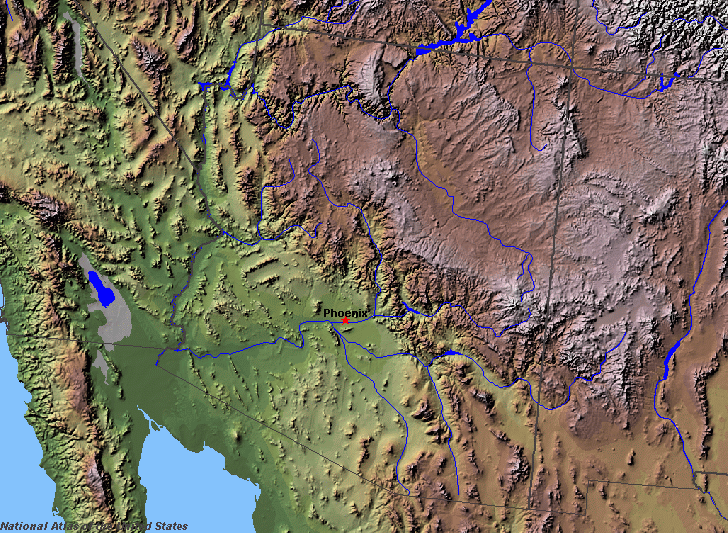
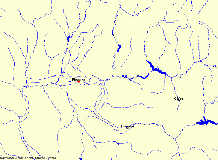
Enlarged view of part of the state river system. The Salt River flows through Phoenix. You can select other parts and your local area from the National Atlas (see below).
|
|
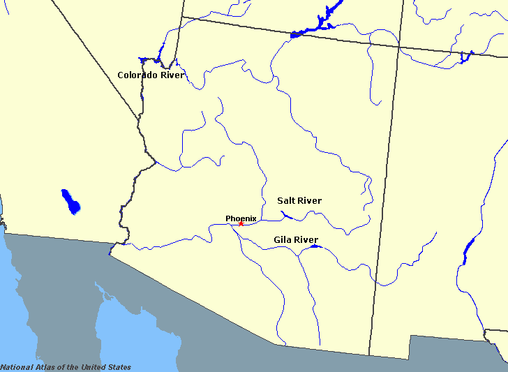
Arizona mainly experiences a desert or semi-arid climate and so the number of rivers and lakes that begin in the state is small. The large rivers that do flow in the state mainly have their headwaters elsewhere. The outstanding example is the Colorado, whose headwaters are in the Colorado Rockies.
Colorado River
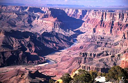
The Grand Canyon.
The Colorado, whose tributaries drain nine tenths of the state, has its headwaters in the state of Colorado. The river flows through Arizona, entrenched deeply in the spectacular 350 kilometres (220 miles) long canyon, of which the deepest and widest part is the Grand Canyon. The tributaries of the Colorado in Arizona play only a minor part in adding to the waters of the main river. The main tributaries are the Little Colorado, which joins at the head of the Grand Canyon, the Bill Williams, which joins close to the Parker Dam and the Gila, which joins the river at the desert city of Yuma. The main lakes are all reservoirs. They include Lake Powell, behind the Glen Canyon dam, Lake Mead behind the Hoover Dam, Lake Mohave, behind the Davis Dam; and Havasu Lake behind the Parker Dam. Gila River
The Gila River.The Gila River is the largest tributary, being some 1000 kilometres (600 miles) long. Its headwaters are in New Mexico, but it then flows right across Arizona, picking up the waters of the Salt River before reaching the Colorado at Yuma. The Coolidge dam on the Gila has created the San Carlos Lake. Salt River
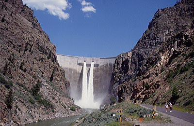
The Roosevelt Dam on the Salt River.
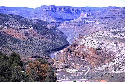
Salt River Canyon.
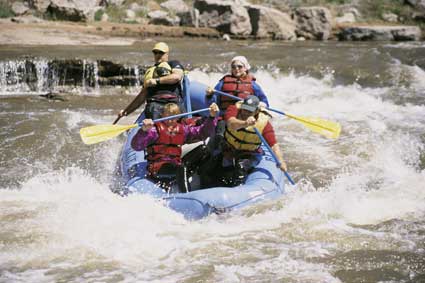
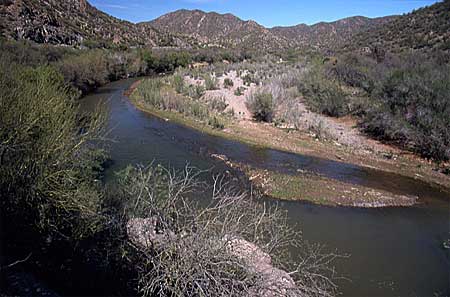
White water rafting on the Salt River.The 300 kilometres (200 miles) long Salt River, which flows to Phoenix and thence to the Gila, is dammed in several places. The main lakes are Theodore Roosevelt, Canyon, Saguaro, and Apache. The Salt River begins in the mountains of Arizona, cutting deep canyons, of which the largest is called the Salt River Canyon.
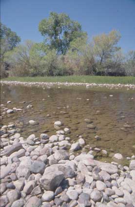
Salt River near Phoenix.
Salt River finally gives out just east of Phoenix for much of the year.
Other rivers are mainly seasonal throughout almost their entire lengths. They are typically wide and shallow and silty as this example from the Canyon de Chelly shows.
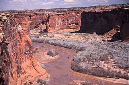
One of many intermittently flowing rivers, this river flows through the Canyon de Chelly.

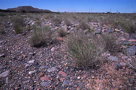
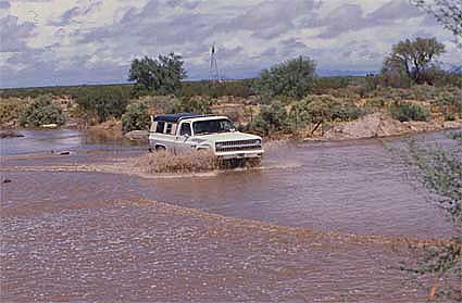
Within the Canyon de Chelly the river is broad and shallow.Over much of the state, and in common with nearby states, many small rivers are liable to summer thunderstorm flash floods. In flat country such flash flood routes can be picked out by the undulations of the roads, and verified when the floods occur as shown below. 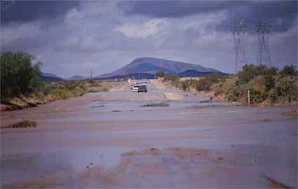
|