|
Location: 52N 6E (Europe); length: 1300 kilometres (800 miles); drainage basin: 250,000 square kilometres (97,000 square miles).
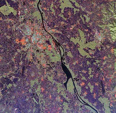
The Rhine Rift Valley. France is on the left, Germany on the right.
The Rhine is the longest river in Western Europe. One of Europe's most important rivers, it begins at a glacier in the St. Gotthard Mountains, Switzerland. The river then flows through Germany, France and the Netherlands before reaching the North Sea. The main cities located beside the Rhine or on tributaries close to their confluence with the Rhine include Basle, Strasbourg, Mannheim, Frankfurt, Cologne, Dusseldorf, Nijmegen and Rotterdam. The upper course of the river is mountainous and the river flows in a deep glaciated valley until it reaches Lake Constance. Downstream of Lake Constance are the Schaffhausen Falls, a high waterfall that interrupts river traffic between the upper and lower reaches of the river. The river is navigable for 1200 ton barges from Basle in Switzerland to the North Sea. This has been of vital importance to landlocked Switzerland as it provides a means of importing bulky goods using cheap transport. Between Basle and Mainz in Germany the river runs northward through the Rhine Rift Valley trapped between the Vosges Mountains of France and the Black Forest of Germany. The river used to meander considerably through the Rift Valley but it has been both straightened and bypassed by canals. The major ports in this stretch of the river are Strasbourg, Karlsruhe, Mannheim and Mainz.
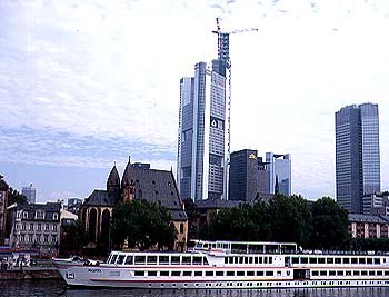
The city of Frankfurt on the River Main.At Mainz the largest tributary, the river Main, joins the Rhine and the combined flow then passes through the famous Rhine Gorge. The Rhine Gorge was important throughout historical times because it is one of the few north-south routeways that people could follow through Europe and it was heavily defended by those who owned land along those banks.
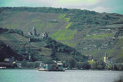
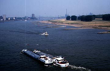
The Rhine Gorge.Tourists visit the Rhine Gorge to see vineyards that line the terraced slopes and to see the remains of the many old castles and tollgates. The most famous of these is the Kaub which is an island tollgate near the southern end of the Gorge. The Gorge is particularly shallow and at times of Spring low water many ships have foundered on the rocks of the river bed. The Lorelei is particularly famous as a place where, in legend, boats crews were attracted on to the Lorelei rocks by the fatal attractions of a mermaid. The River Rhine is joined by the River Mosel at Koblenz. At Bonn (the West German capital) the river widens and flows out from the gorge to the North German Plain. Cologne is one of the most important and ancient cities at the northern end of the Rhine Gorge. Near to where the small tributary River Ruhr enters the Rhine lies the most important heavy industrial region of Germany with its cities such as Essen, Duisburg and Dortmund. The lower Rhine is flanked with heavy industries such as steelworks and chemical factories. Below this point the Rhine flows into the Netherlands. This is a low-lying part of the river and the banks have to be heavily diked on both sides to prevent flooding. Rotterdam is the last city by the Rhine, being 50 kilometres (30 miles) from the sea. It is the biggest port in Europe and the second most important port in the world. Beyond Rotterdam and its docks lies the new port of Europort where oil tankers and bulk cargo carriers berth. The Hook of Holland is a spit of land which marks the furthest point of the delta of the Rhine. Because the Rhine flows through the heart of Europe and has so many industrial sites along its banks, it has become heavily polluted and great efforts are under way to clean it up again
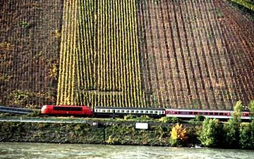
The Rhine gorge, showing the vineyards clothing the south-facing slopes and the small amount of space available for a railroad and highway.
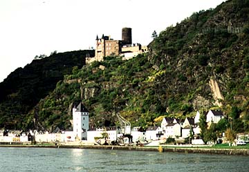
The Rhine gorge with one of the many medieval castles used as tollgates for safe passage during the Middle Ages.
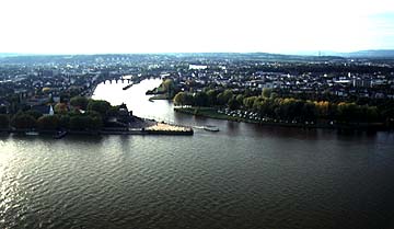
This is a view taken from the fortress of Ehrenbreitstein which overlooks the confluence of the Rhine and the Mosel. The view looks south across Koblenz with its ancient bridges up the Mosel to the volcanic hills of the Eifel.
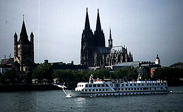
The Rhine at Cologne (Koln), showing the cathedral built on river terrace land just above the level of flooding.
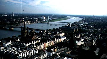
The Rhine at Cologne, taken from the cathedral, showing the many bridges that cross the river at this point. Cologne grew up as a bridging point of the Rhine just to the north of the Middle Rhine Highlands. It is paralleled by the site of Frankfurt to the south. Both cities prospered on trade that resulted from the crossing of trade routes.
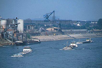
The Rhine at Duisburg close to where the Rhine and Ruhr rivers meet. This is the heart of the industrial Ruhr area which grew up on the nearby coalfield. The importance of barge traffic on the Rhine is strikingly obvious in this picture. Notice also the training walls built into the river to concentrate the river in the center of its channel and so help natural scouring.
|