|
Location: 35N 110E (China); length: 4850 kilometres (3000 miles); drainage basin: 750,000 square kilometres (300,000 square miles). 
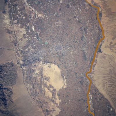
The Huang He flowing near the silty hills which provide it with much of the yellow colored silt which gives it a special color.
The Huang He (He means 'river') is also known as the Yellow River because of its high sediment content and yellow color, and also as 'China's sorrow' because of the number of deaths that have been caused from flooding. The Huang He is China's second longest river, after the Chang Jiang. It rises in Tibet and flows eastward in a great arc, crossing through the Great Wall of China twice and then passing through rolling silt (loess) hills before flowing out onto the vast North China Plain to the Yellow Sea.

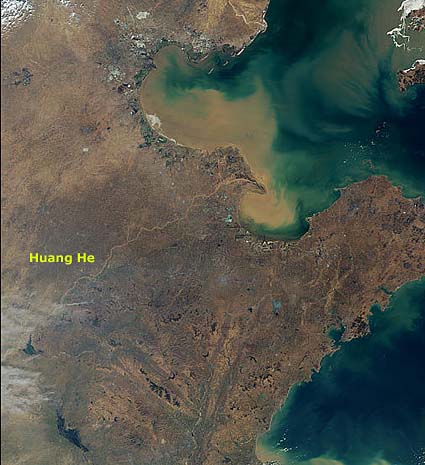
The Huang He delta.
Much of this region experiences only low rainfall totals and so the flow in the river is low compared with the Chang Jiang. Like most low rainfall regions, the rainfall totals vary greatly from year to year and so the flow in the river is very variable. There are, however, two rainy seasons (late spring and late summer) and it is in these times that the river can flood. The upper river waters are completely clear. The silt, and therefore the yellow color of the water are acquired as the river flows through the silty hills. Here, tributaries erode the soft material and carry it to the Huang He. The river is estimated to carry 1.4 billion tonnes of sediment each year. The Huang He deposits much of this sediment in the Yellow Sea, making it the world's fastest growing delta, growing outward on average by about 2 kilometres (1 mile) a year. The main tributary of the Huang He is the Wei He. Below this point, the river flows through the Sanmen Gorge where a dam controls the flow for hydroelectricity, flood control and irrigation. The lower reaches of the Huang He, as it flows across the North China Plain, are very wide and shallow. Natural levees have built up on both banks. Because of intense cultivation of the silt hills and the consequent removal of the natural protective forest cover, far more sediment now reaches the Huang He than in the past. This is causing the river to deposit much more material on its bed, and it now flows up to 10 m (30 feet) above the floodplain. The high levees cannot now easily withstand the weight of river water and it overtops its levees more frequently. Tens of millions of people live in the floodplain of the Huang He. The region around the confluence of the Wei He and the Huang He is regarded as the birthplace of Chinese civilization. The main cities situated beside the river are Xi'an (on the Wei He), Zhengzhou and Jinan. Whenever the river overtops its levees there is a chance that it will flow in a completely new course. In the last 5000 years (since Chinese records have been kept) the river has overtopped its levees 1500 times and changed course 26 times. To try to 'tame' the river, successive Chinese Emperors have commissioned control schemes and such schemes have been undertaken with renewed vigor since the Communist government came to power. |