|
Location: 45N 93E (India); length: 3000 kilometres (1900 miles); drainage basin: 940,000 square kilometres (360,000 square miles).
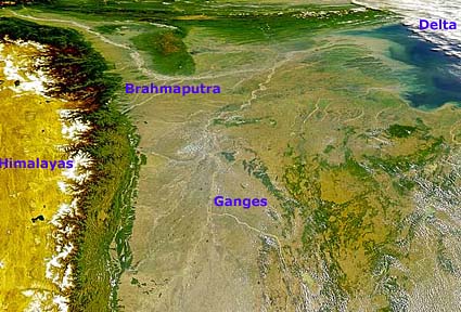
The Brahmaputra meets the Ganges at Bangladesh.
The Brahmaputra is one of the world's longest rivers, stretching from the Himalayas through Tibet, China and India to reach the Bay of Bengal. Like the other major rivers that flow to the Bay of Bengal and the Indian Ocean, the Brahmaputra does not have its headwaters on the southern side of the Himalayas, but on the north slope. It therefore begins by flowing north, then changes direction and flows south through a gorge some 7800 m (23,000 feet) deep between the world's highest peaks, before finally emerging in the plains of Bangladesh. This strange pattern occurs because the river existed before the Himalayas were formed. As the Himalayas rose, so the powerful river cut down and maintained its earlier course. The Brahmaputra transports sediment eroded from the Himalayas to its delta on the Bay of Bengal. Through its annual floods it deposits part of this sediment as a thin layer over the delta, thereby renewing the fertility of the soils. Some sediment is deposited at the oceanward edge of the delta, where it creates new islands. Each emerging delta island is colonized by farmers desperate for new land. The floods of the Brahmaputra bring both benefits, in the form of fertile sediment and new land, and hardships in the form of risk through drowning. The Brahmaputra has flooded more often and with greater severity in recent years because the Himalayas are being rapidly deforested, allowing runoff to reach the river more quickly. The waters of the river are used for dry season irrigation, and competition for water rights is a source of argument between India and Bangladesh. The Brahmaputra is navigable as far as Dibrugarh in India about 1300 kilometres (800 miles) from the Bay of Bengal.
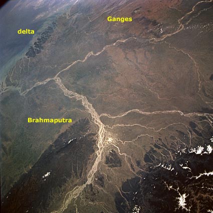
The confluence of two of south Asia's great rivers, the Brahmaputra and the Ganges, is visible near the southern edge of this southwestern-looking, high-oblique photograph. The Sun's reflection off the water (sunglint) helps identify many water channels within the floodplain of the Brahmaputra River as it curves around the heavily forested Khasi Hills of northeast India.You can easily see the Brahmaputra's tributaries that flow generally southward off the foothills of the Himalaya Mountains and the southeasterly-flowing Ganges. Both rivers have braided channels.
These two great rivers merge in the small, low-lying country of Bangladesh, most of which is shown in this photograph.
The Sundarbans, the most extensive mangrove forest in the world and the habitat for the endangered Bengal tiger, is the dark area in the extensive delta created along the northern edge of the Bay of Bengal. Because large quantities of fertile soils are deposited in the delta and throughout Bangladesh, this heavily populated region is well endowed with rich soils for farming; however, the monsoons can produce devastating damage and loss of human life, especially for the people in the flood-prone, low-lying area.
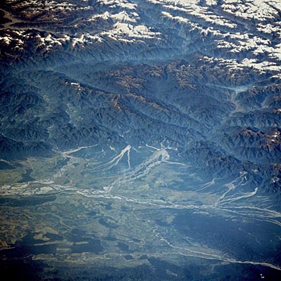
The flow of the Brahmaputra through the Himalayas is shown here. To get a clearer view look at the picture below.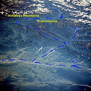
This is the same picture as the one above except that the river and the mountains are highlighted. |