|
Location: 24N 33E (northeast Africa); length: 6700 kilometres (4100 miles); drainage basin: 3.3 million square kilometres (1.3 million square miles).
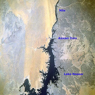
Lake Nasser as seen from space.
The Nile, famous since ancient times as the site of the Ancient Egyptian civilization, is the world's longest river. More than 3200 kilometres (2000 miles) of the Nile are navigable. The source of the White Nile (the subject of many expeditions in the 19th century) is in the East African Rift Valley in Burundi. The source of the Blue Nile is in the Ethiopian Highlands. The word Nile probably comes from the Semitic word nahal, or river valley. The Nile's development and exploration is an extraordinary story. Although it was the focus of the Ancient Egyptian civilization for thousands of years, the sources of the river were never explored, and so the origin of the annual flood, on which all Egyptian agriculture depended, remained a mystery. The first person to travel from the mouth of the Nile to the headwaters of the Blue Nile was the Spaniard Pedro Paez in 1613, but it was only in 1860 that Englishman John Speke, was able to identify the source of the White Nile.
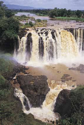
Tisisat Falls just below Lake Tana in the highlands of Ethiopia. Lake Tana is the source of the Blue Nile.Because the river flows for such a great part of its length through desert, it has few tributaries for much of its length. Even in its headwaters there are few tributaries leading directly into the river because the headwaters first feed Lake Albert and Lake Victoria in the East African Rift Valley. The Nile leaves the lakes at the Kabalega Falls in Uganda. From here, until it reaches the Sudd swamplands, the Nile follows a steep rocky terrain and is known as the Bahr-el-Jebel ('river of the mountain'). As the Nile reaches flatter land, it broadens out and is lost in a vast swamp region known as the Sudd. The Sudd acts as a natural sponge, absorbing water from storms and releasing it more evenly throughout the year. In this way the Sudd maintains water in the Nile throughout the year. The waters that emerge from the Sudd (now called the White Nile) make up just under a third of the entire water of the Nile. The majority of the Nile's water, and the source of its annual flood, comes from the Blue Nile, which drains the Ethiopian Highlands. The rainy season in the Ethiopian Highlands lasts through April and May, and this is the time when the Nile flood is formed. However, because the river system is so long, the flood wave doesn't arrive in the Cairo region until October. The White and Blue Niles have their confluence at the Sudanese capital of Khartoum, and from here the Nile gains hardly any additional water. The reach of the Nile from Khartoum to Aswan in Egypt is in the form of a giant S bend, with the river's otherwise gentle flow punctuated by six rapids, or cataracts. Below Aswan the river flows in a gentle course to its delta in the Mediterranean Sea. The Nile has been so important because it flows through a region that could otherwise not support a dense settlement of people. Until the construction of the Aswan High Dam in 1953, and the creation of Lake Nasser behind it, the annual flood, and the sediment it contains, brought a renewal of soil that allowed crops to be grown the following year without any additional fertilizer. The construction of the dam has not lessened the relationship of people to the river, however, because the dam allows a fifth more land to be irrigated than was possible before its construction.
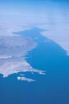
Lake Nasser is one of Africa's largest lakes. It is impounded behind the Aswan High Dam.
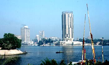
The Nile at Cairo.
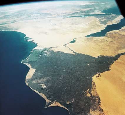
The Nile Delta from space.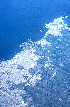
Part of the Nile Delta and Alexandria, Egypt's second city. |