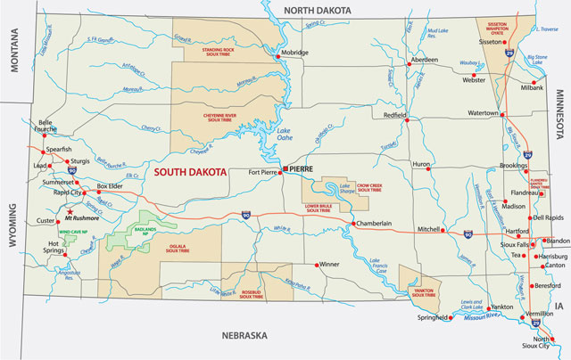
South Dakota includes two geographic areas. The eastern two-fifths of South Dakota is prairie, and is part of the Central Lowlands. The western three-fifths is on the Missouri Plateau, which is part of the Great Plains region. The Great Plains region contains many high buttes, canyons, and level tablelands. This section of the Great Plains also includes the Badlands, an area of eroded rock which extends along the White and Cheyenne rivers for more than 100 miles (160 km). The Badlands contain many fossils of prehistoric animals. The center of the state is a transition zone between the prairie and the Great Plains. Two-thirds of the Black Hills are also in South Dakota (the remaining one-third is in Wyoming). Harney Peak, near the center of the Black Hills, is the highest point in the state, and the highest point in North America east of the Rocky Mountains (7,242 feet/2,207 meters). South Dakota’s lowest elevation (966 feet/295 meters), is at Big Stone Lake, in the northeastern corner of the state.
Flowing south and southeast, the Missouri River cuts a huge swath through the heart of South Dakota before forming part of the southeastern boundary. Tributaries of the Missouri include the Grand, Cheyenne, Bad, Moreau, and White rivers in the west and the James, Vermillion, and Big Sioux in the east. Today, the Missouri River is controlled by four massive dams—Gavins Point, Ft. Randall, Big Bend, and Oahe—which provide water for irrigation, flood control, and hydroelectric power. Major lakes in the state include Traverse, Big Stone, Lewis and Clark, Francis Case, and Oahe.
South Dakota has an interior continental climate, with hot summers, very cold winters, high winds, and low rainfall. The skies are generally clear. Temperatures range from lows of near 0 °F (–18 °C) in January to highs in the upper 80s F (about 31 °C) in July. The normal January temperature is 12°F (–11°C); the normal July temperature, 74°F (23°C). The record low temperature is –58°F (–50°C), set at McIntosh on 17 February 1936; the record high, 120°F (49°C), at Gannvalley on 5 July 1936. Extreme low temperatures near –40 °F (–40 °C) and extreme high temperatures of around 115 °F (44 °C) can also occur. South Dakota receives only around 20in (500 mm) of rain each year, but some areas receives 40in (1000mm) or more of snow.